


National Old Trails Road
1917-1926

The National Trails System is a collection of trails throughout the United States designated to promote preservation, public access, travel, and enjoyment of the nation's open-air, outdoor areas and historic resources. Four types of trails are available: national scenic trails, national historic trails, national recreation trails, and connecting or side trails. These trails offer a range of activities, from hiking and historical education to horseback riding, biking, camping, scenic driving, water sports, and others. The National Trails System consists of 11 national scenic trails, 21 national historic trails, over 1,300 national recreation trails, seven connecting and side trails, and one national geologic trail, totaling more than 91,000 miles (150,000 km). The scenic and historic trails are present in every state. Virginia and Wyoming have the most significant number, with six each.
The Bureau of Outdoor Recreation produced a report titled Trails for America in 1966 in response to President Lyndon B. Johnson's appeal for a cooperative program to construct public trails for "the forgotten outdoorsmen of today" in urban and backcountry areas. The report suggested a network of national scenic trails, park and forest trails, and metropolitan area trails to provide recreational opportunities. The study evaluated several possible trails, both scenic and historic. The National Trails System Act, passed on October 2, 1968, created the program for long-distance natural trails and designated two national scenic trails, the Appalachian Trail and the Pacific Crest Trail, while requesting that fourteen additional trail routes be studied for possible inclusion. Senators Henry M. Jackson, Gaylord Nelson, and Representative Roy A. Taylor sponsored the bill. A significant impetus for the bill was the threat of development along the Appalachian Trail, which was at risk of losing its wilderness character. The Land and Water Conservation Fund was used to acquire lands.
In 1978, four trails were designated as a new category of national landmark trails due to the study of the most significant trails for their historic associations. Since 1968, over forty trail routes have been investigated for inclusion in the system.
The scenic and historic trails comprise long-distance trails established by the National Park Service (NPS), United States Forest Service (USFS), and Bureau of Land Management (BLM) to protect critical rights of way, sites, resources, and viewsheds. Though lacking fixed boundaries, these trails collaborate with each other, states, local governments, land trusts, and private landowners to coordinate and safeguard lands and structures along these trails, making them accessible to the public. Such partnerships between the agency administrators and local site managers are fundamental for resource protection and visitor experience. The Federal Interagency Council on the National Trails System facilitates collaboration and standardization in trail development and security. National recreation trails and connecting and side trails do not require congressional action. Still, they are recognized by actions of the secretary of the interior or agriculture. Private non-profit organizations, volunteers, and trail-type-specific advocacy groups support the national trails by working with federal agencies under the Partnership for the National Trails System.
For fiscal year 2021, the NPS administered 24 trials with a budget of $15.4 million.
The eleven national scenic trails aim to provide outdoor recreation opportunities and conserve significant scenic, natural, cultural, or historic portions of the natural landscape. These continuous non-motorized long-distance trails can be backpacked from end-to-end or hiked for short segments, except for Natchez Trace NST, which consists of five shorter, disconnected trail segments. The Trails for America report stated, "Each National Scenic Trail should stand out in its own right as a recreation resource of superlative quality and physical challenge." The national scenic trail system provides access to the crest of the Appalachian Mountains in the east via the Appalachian Trail, of the Rocky Mountains in the west on the Continental Divide Trail, and of the Cascade and Sierra Nevada ranges on the Pacific Crest Trail, which constitutes the Triple Crown of Hiking. The Florida Trail offers access to the southern wetlands and Gulf Coast, the North Country Trail provides access to the North Woods, the Arizona Trail showcases the variety of southwestern mountains and ecosystems, and the Pacific Northwest Trail displays the remote high-mountain landscape near the Canadian border.
The trails extend approximately 17,800 mi (28,650 km), with distances reported varying due to the extent of construction of route realignments, segment alternatives, and measurement methods.
The NPS manages six trails as long, linear parks, similar to its other areas, while the USFS oversees five trails.
In 2022, Arlette Laan, trail name "Apple Pie," became the first known woman to complete all eleven national scenic trails.

U.S. Route 66
Will Rogers Memorial Highway 1926-1985

The National Trails System is a collection of trails throughout the United States designated to promote preservation, public access, travel, and enjoyment of the nation's open-air, outdoor areas and historic resources. Four types of trails are available: national scenic trails, national historic trails, national recreation trails, and connecting or side trails. These trails offer a range of activities, from hiking and historical education to horseback riding, biking, camping, scenic driving, water sports, and others. The National Trails System consists of 11 national scenic trails, 21 national historic trails, over 1,300 national recreation trails, seven connecting and side trails, and one national geologic trail, totaling more than 91,000 miles (150,000 km). The scenic and historic trails are present in every state. Virginia and Wyoming have the most significant number, with six each.
The Bureau of Outdoor Recreation produced a report titled Trails for America in 1966 in response to President Lyndon B. Johnson's appeal for a cooperative program to construct public trails for "the forgotten outdoorsmen of today" in urban and backcountry areas. The report suggested a network of national scenic trails, park and forest trails, and metropolitan area trails to provide recreational opportunities. The study evaluated several possible trails, both scenic and historic. The National Trails System Act, passed on October 2, 1968, created the program for long-distance natural trails and designated two national scenic trails, the Appalachian Trail and the Pacific Crest Trail, while requesting that fourteen additional trail routes be studied for possible inclusion. Senators Henry M. Jackson, Gaylord Nelson, and Representative Roy A. Taylor sponsored the bill. A significant impetus for the bill was the threat of development along the Appalachian Trail, which was at risk of losing its wilderness character. The Land and Water Conservation Fund was used to acquire lands.
In 1978, four trails were designated as a new category of national landmark trails due to the study of the most significant trails for their historic associations. Since 1968, over forty trail routes have been investigated for inclusion in the system.
The scenic and historic trails comprise long-distance trails established by the National Park Service (NPS), United States Forest Service (USFS), and Bureau of Land Management (BLM) to protect critical rights of way, sites, resources, and viewsheds. Though lacking fixed boundaries, these trails collaborate with each other, states, local governments, land trusts, and private landowners to coordinate and safeguard lands and structures along these trails, making them accessible to the public. Such partnerships between the agency administrators and local site managers are fundamental for resource protection and visitor experience. The Federal Interagency Council on the National Trails System facilitates collaboration and standardization in trail development and security. National recreation trails and connecting and side trails do not require congressional action. Still, they are recognized by actions of the secretary of the interior or agriculture. Private non-profit organizations, volunteers, and trail-type-specific advocacy groups support the national trails by working with federal agencies under the Partnership for the National Trails System.
For fiscal year 2021, the NPS administered 24 trials with a budget of $15.4 million.
The eleven national scenic trails aim to provide outdoor recreation opportunities and conserve significant scenic, natural, cultural, or historic portions of the natural landscape. These continuous non-motorized long-distance trails can be backpacked from end-to-end or hiked for short segments, except for Natchez Trace NST, which consists of five shorter, disconnected trail segments. The Trails for America report stated, "Each National Scenic Trail should stand out in its own right as a recreation resource of superlative quality and physical challenge." The national scenic trail system provides access to the crest of the Appalachian Mountains in the east via the Appalachian Trail, of the Rocky Mountains in the west on the Continental Divide Trail, and of the Cascade and Sierra Nevada ranges on the Pacific Crest Trail, which constitutes the Triple Crown of Hiking. The Florida Trail offers access to the southern wetlands and Gulf Coast, the North Country Trail provides access to the North Woods, the Arizona Trail showcases the variety of southwestern mountains and ecosystems, and the Pacific Northwest Trail displays the remote high-mountain landscape near the Canadian border.
The trails extend approximately 17,800 mi (28,650 km), with distances reported varying due to the extent of construction of route realignments, segment alternatives, and measurement methods.
The NPS manages six trails as long, linear parks, similar to its other areas, while the USFS oversees five trails.
In 2022, Arlette Laan, trail name "Apple Pie," became the first known woman to complete all eleven national scenic trails.
New Mexico U.S. 66
1926-1985

U.S. Route 66, also known as Route 66, used to run across the central part of New Mexico in an east-west direction. The current route is taken by Interstate 40 (I-40). However, before 1937, a longer route passed through Los Lunas, Albuquerque, and Santa Fe. This route is now roughly covered by New Mexico State Road 6 (NM 6), I-25, and U.S. 84. Today, portions of the old road that run parallel to I-40 have been designated NM 117, NM 118, NM 122, NM 124, NM 333, three separate loops of I-40 Business, and state-maintained frontage roads. The route is one of the roads on the Trails of the Ancients Byway and one of the designated New Mexico Scenic Byways.
History
Route 66 in New Mexico was created by combining two auto trails - the National Old Trails Road from Arizona to Santa Fe, Albuquerque, and near Las Vegas, and one of the main routes of the Ozark Trails network from that point into Texas. The state government managed these roads under several numbers, including NM 6 from Arizona to Los Lunas, NM 1 through Albuquerque and Santa Fe near Las Vegas, NM 56 to Santa Rosa, the short NM 104 to Cuervo, and part of NM 3 to Texas. While NM 56 and NM 104 were entirely replaced by U.S. 66, NM 6 was realigned to a route branching off from U.S. 66 (old NM 6) at Laguna and heading straight east through Albuquerque, Moriarty, and Palma to U.S. 66 at Santa Rosa. Except for the stretch between Albuquerque and Moriarty, included in US 470, this was an unimproved road.
New Mexico was controlled politically by the Santa Fe Ring, a group of businesspeople and officials with close ties to the Republican Party until 1924, when Democrat Arthur Thomas Hannett unexpectedly won the governorship for a single term (1925-1927). Blaming the Republican establishment in Santa Fe for his defeat, Hannett used the remainder of his term to push through a new 69-mile cutoff from Santa Rosa directly to Albuquerque, bypassing Santa Fe completely. The new road was constructed hastily and opened on January 3, 1927, while incoming governor Richard Dillon was still trying to get construction stopped. Dillon's term ended in 1931, and Arthur Seligman, a Democrat, replaced him.
This new NM 6 was approved as a future realignment of Route 66 by 1932, and in 1933, a new bridge over the Rio Puerco was opened. Once paving was complete in 1937, the American Association of State Highway Officials approved the new route on September 26, 1937. Route 66 was moved to this shorter route, known as the Laguna Cutoff, to the west of Albuquerque and the Santa Rosa Cutoff to the east, after which the bypassed roads became NM 6 once again to the west and part of U.S. 84 to the east.
Route Description
The section of U.S. Route 66 from the Arizona state line to the Grants area is mountainous and winding. It passes through Indian reservations and the Laguna Indian Pueblo at Laguna, New Mexico. The highway initially went through Albuquerque from south to north along Fourth Street, part of the historic El Camino Real de Tierra Adentro. However, now it has been replaced by I-25 through Santa Fe to almost Las Vegas, with several old sections still existing. From south of Las Vegas back to I-40, the road has been replaced with U.S. 84. When I-40 was established, it bypassed the main parts of towns. The later and more popular alignment continued west to Albuquerque, becoming Central Avenue through the city. East of Albuquerque, US 66 is now NM 333 to Moriarty. A stretch of NM 333 in Tijeras is a musical road, with rumble strips that play "America the Beautiful." I-40 east of Moriarty to Santa Rosa was built by adding a second set of lanes to U.S. 66. East of Santa Rosa, US 66 is primarily frontage roads for I-40 or business loops for Santa Rosa and Tucumcari. At San Jon, the original alignment continues to the Texas state line at the historic ghost town of Glenrio. The New Mexico Madonna of the Trail, one of a dozen monuments commemorating the hardships of early pioneer travelers on the National Old Trails Road, stands on U.S. 66 in Albuquerque. Albuquerque also boasts the 1927 Art Deco-themed KiMo Theater and the first modern suburban shopping mall in New Mexico, Nob Hill.
Historic Districts
Fort Wingate, now an abandoned military installation located east of Gallup, has a dark history dating back to the 19th century. During this time, the U.S. government made attempts to relocate Navajo people to native reservations by force. Later, the fort was used as a defense against the Apache. Although the fort was closed in 1912, it was briefly reopened to house prisoners during World War I and II.
The Barelas-South Fourth Street Historic District is a neighborhood in Albuquerque that used to be inhabited by Hispanics. It features a collection of commercial buildings from different eras, including those built during the arrival of the Atchison, Topeka, and Santa Fe Railway and the later construction of U.S. 66.
The Park Lake Historic District is a 25-acre municipal park located on a lake in Santa Rosa. The park also includes the natural Blue Hole Lake, sourced from a vast underground water system. Constructed between 1934 and 1940 under the Works Progress Administration, the park was a make-work project designed to provide employment opportunities during the Great Depression.
Restaurants
The building that once housed the Jones Motor Company in Albuquerque, which was initially a motorcar dealership, has been repurposed as the local Kelly's Brew Pub.
Service Stations
Richardson's Store in Montoya was established in 1901 to provide supplies for the Rock Island Railroad workers and ranchers. Later, when Route 66 came to the town, the store started selling groceries and auto supplies. However, it had to be closed once the I-40 bypassed the community.
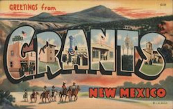
Roy T. Herman's Garage and Service Station was founded in 1935 in Grants. However, it was moved to Thoreau in 1937 as Route 66's routing changed. This move was made to retain its Route 66 clientele.
Trading Posts
New Mexico is known for its rich Native American history and culture. The state is home to two Pueblos, the Santo Domingo (Kewa Pueblo) and the Laguna Pueblo. The design of early trading posts, which served the Native American communities, inspired roadside merchants on Route 66 to base their stores on them. The De Anza Motor Lodge and the surrounding Nob Hill neighborhood in Albuquerque served as a trading post for the Zuni Pueblo. Bowlin's Old Crater Trading Post in Bluewater, originally a Native trading post, now stands vacant. The proprietors of the trading post later established a modern chain of highway service centers. The 1939 Maisel's Indian Trading Post in Albuquerque, once a hub of native craftspeople, reopened in the 1980s and is still in operation today.
Camps, Motor Courts & Motels
Numerous towns and cities along Route 66 established strips of roadside motels to accommodate the growing traffic of travelers. Tucumcari, in particular, promoted "2000 motel rooms" (later reduced to "1200 motel rooms" due to the construction of I-40 and a decline in visitors) on roadside signs that spanned hundreds of miles, featuring the slogan "Tucumcari tonight!" The Blue Swallow Motel, a 12-room, neon-lit establishment built in 1939, has been historically restored and is presently listed on the National Register of Historic Places. Another nearby motel, the Motel Safari, constructed in 1959 by Chester Dohrer, has undergone recent restoration. Its mid-century modern retro design features "Doo Wop" or "Googie" styled architecture that highlights boomerangs, holes in cinder blocks, counter-stacked bricks protruding from the facade, whimsical metal cylinders that light up at night, and a renowned camel atop its neon sign that pays homage to the U.S. Camel Corps. The Corps passed through the area in the 1800s during a surveying expedition for a future national road system.
Central Avenue in Albuquerque used to have many motels from the Route 66 era. Unfortunately, some motels, such as the Aztec Motel, have been demolished for modern developments. However, some historic Albuquerque lodgings from Route 66's heyday remain standing, such as the Luna Lodge, Tewa Motor Lodge, De Anza Motor Lodge, and El Vado Auto Court. Although some of these motels are currently closed, the local community is working to ensure their historic preservation.
Some hotels, such as De Anza Motor Lodge and El Vado Motel, have been revitalized along the historic Route 66 in Albuquerque to keep this era alive. As for the El Rancho Hotel in Gallup, it has served as a temporary home for many movie stars.
Bridges and Road Segments
The Rio Puerco Bridge is a Parker Through truss bridge constructed in 1933 to cross the Rio Puerco. Eleven different road segments on U.S. Route 66 in New Mexico are listed on the National Register of Historic Places. These segments initially included wooden bridges to carry the road through flood plains. The road segments that are listed include Glenrio to San Jon; San Jon to Tucumcari; Palomas to Montoya; Montoya to Cuervo; Cuervo to NM 156; Albuquerque to Rio Puerco; Laguna to McCartys; McCartys to Grants; Milan to Continental Divide; Iyanbito to Rehobeth; and Manuelito to the Arizona border.
Related Routes
These routes were designated along former alignments of U.S. 66 throughout the state.
State Road 118, also known as NM 118, is a state highway in New Mexico that spans 36.852 miles (59.308 km). The road starts at the Arizona-New Mexico border. It runs eastward to its endpoint at Interstate 40 (I-40) in the northeast region of Fort Wingate. The entire route is located in McKinley County. NM 118 follows the path of the former Historic U.S. Route 66.
State Road 122, also known as NM 122, is a highway that runs for 38.740 miles (62.346 km) across New Mexico. The highway starts at the western end of Thoreau, where it meets Interstate 40 (I-40), and ends at Grants, which also intersects I-40. NM 122 follows the path of the former U.S. Route 66, a historic route in the United States. On September 20, 2018, during a Transportation Commission meeting, the bridge carrying NM 122 over I-40 was named the "Sgt. Jackson Gibson Memorial Bridge" in honor of Jackson Gibson's service as a veteran, community leader, and state transportation commissioner. [42]
State Road 124 (NM 124) is a highway running 25.523 miles (41.075 km) in New Mexico. It starts at NM 117, southeast of Grants, and ends at Interstate 40 (I-40), east of Laguna. The route of NM 124 follows the path of the former Historic U.S. Route 66. The highway is situated entirely in Cibola County.
NM 333 is a highway commencing in eastern Albuquerque at Tramway Boulevard (NM 556) and Central Avenue. It then proceeds east on Central, which was once the route of the former U.S. Route 66 (U.S. 66). After a partial interchange with Interstate 40 (I-40), the highway enters the Sandia Mountains through Tijeras Canyon, where it crosses to the north side of I-40 in a diamond interchange. After passing through Carnuel, it crosses back to the south side of I-40, although this crossing has no interchange.
Just before entering the town of Tijeras, there is a former location of a "musical road" feature where rumble strips were arranged to play America the Beautiful for eastbound travelers. Once in Tijeras, the highway intersects NM 337, which travels to the southeast, and NM 14, which heads northeast to Santa Fe. Continuing east, NM 333 passes through Sedillo and intersects with the former NM 306 and NM 217. The highway then leaves Bernalillo County and enters Santa Fe County and Edgewood, intersecting NM 344. Shortly after that, the road enters Torrance County and the city of Moriarty, where it ends at an intersection with I-40 Business (I-40 Bus.).
NM 333 follows the routing of the former Historic U.S. Route 66.


State Road 118
State Road 122

State Road 124


State Road 333

1927 Rand McNally Auto Road Map of Arizona and New Mexico
Section Title
Section Title
This is a Paragraph. Click on "Edit Text" or double click on the text box to start editing the content and make sure to add any relevant details or information that you want to share with your visitors.
This Is Grants/Milan New Mexico