
Downtown Grants
500 W. Santa Fe Avenue
at Fifth Street.
Route Shields of Grants-Milan and
surrounding areas on or connecting to
Historic US Route 66


1912-1926

1912-1926

1926-1948

1948-1961

1961-1971

1971-1985

1912-1927

1927-Present

1972-Present

1988-Present

1951-Present

1985-Present


1985-Present

1985-Present

1991-Present

1998-Present

1998-Present

2010-Present
George Ades Parcel
The 1100 block of West Santa Fe Avenue represents one of the earliest developed areas of Grants, tracing its origins back to the original settlement of Los Alamitos, established in 1872 prior to the arrival of the railroad. The corridor later expanded during the railroad era following the arrival of the Atlantic & Pacific Railroad in 1881, developing along a long-established travel route.
Santa Fe Avenue serves as the town’s primary main street and historic Route 66 corridor, reflecting Grants’ transition from early settlement into a regional service center. Over time, this route evolved from early regional trails into the National Old Trails Road, eventually becoming the central commercial artery of the community.
GEORGE ADES
xxxx - xxxx
Operator: Violetta Hoisington
The Yucca Hotel was developed beginning in 1909 through the partnership of George A. Ades and stonemason Joseph “Joe” Capelli, marking a major step in the transformation of the 1100 block of West Santa Fe Avenue into a structured commercial district. The project required the demolition of Latham’s Stockman’s Store, the original Latham location established on this site in 1882, which remained in operation here until 1910. The business later relocated within Grants before eventually returning to this original location in 1968.
Positioned directly across from the S. Bibo Brothers Mercantile (1105–1115 W), and within close proximity to the Atlantic & Pacific Railroad depot located behind the mercantile, the Yucca was strategically placed at the center of Grants’ early economic activity. This location allowed the hotel to serve railroad workers, traveling salesmen, and early automobile traffic moving through the corridor.
Working together, Ades and Capelli combined development and construction expertise to create a building that functioned as both a lodging establishment and a commercial hub. Their work reflects the shift from early settlement structures to more permanent business buildings, signaling the continued growth of Grants from its Los Alamitos origins into a functioning regional service center.
Abe's Liquor Store (Before and After)

COMING SOON
(No surviving pre‑Yucca block photo)

Earliest 1928–1929 horizontal sign photo
-
Same‑day bus photo
-
Horizontal sign installed
-
Pole removed
-
Lamp posts visible
-
Scaffold mount visible
Artifact: Recreation of the 1910–1927 Yucca Hotel rooftop sign based on later photographic evidence
Source: Cibola County Historical Museum — earliest 1928–1929 Yucca Hotel horizontal sign photograph (lamp posts visible, pole removed, scaffold mount)
Retrieved from: Cibola County Historical Museum photo archives; 1928–1929 streetscape reference materials
Caption: Rooftop sign recreation informed by the 1928–1929 horizontal sign photo showing lamp posts, scaffold mount, and the earliest surviving evidence of the hotel’s signage evolution
Building Spec List for the LUX Theater
● Designed by: ○ George Ades (owner/developer) ○ Joseph “Joe” Capelli (stonemason / craftsman / installer)
● Built by: ○ George Ades (owner/builder) ○ Joseph “Joe” Capelli (stonemason / construction and fabrication)
● Building / Sign Style: ○ Two‑story Spanish‑style exterior ○ Frame and stucco construction
● Built: ○ Construction began 1909 ○ Building completed 1910
● Opened: ○ 1910 (hotel begins operation) ○ 1911 — Charles Katzung becomes first confirmed manager
○ Earlier employment possible but undocumented
● Units / Rooms / Dimensions:
○ 13 upstairs guest rooms
○ 7 downstairs business rooms ○ 20 rooms total
● Amenities: ○ Pool: ○ None ○ Playground: ○ None
● Materials: ○ Wood framing ○ Stucco exterior ○ Early storefront façade elements
● Colors: ○ Period‑appropriate neutral stucco tones ○ Dark trim (per early photos)
● Mounting / Construction: ○ Traditional early‑20th‑century frame‑and‑stucco build
○ Street‑facing façade with early signage mount
Era Covered: ○ 1909–1912 (construction through early operation)
Operational Notes: ○ Lodging and dining operation ○ Served railroad workers, early auto travelers, and locals ○ Stable early operation under Katzung (from 1911)
● Identification Method: ○ Painted horizontal sign mounted at roof edge
● Period Context: ○ Territorial‑to‑statehood transition (NM statehood 1912) ○ Early automobile travel era
● Regional / Community Role: ○ Early anchor business in the Grants commercial core ○ Provided meals and lodging for local workforce
● Years in Service: ○ 56 years (1910–1966)
● Demolished / Fate:
○ Demolished 1966
Sign Spec List for the Yucca Hotel
● Designed by: ○ George Ades (owner/developer) ○ Joseph “Joe” Capelli (stonemason / craftsman / installer)
● Built by: ○ George Ades (owner/builder) ○ Joseph “Joe” Capelli (stonemason / construction and fabrication)
● Built: ○ Construction began 1909 ○ Installed by 1910 at hotel opening
● Installation: ○ In use by 1910
○ Still in use under Katzung by 1911
○ Earlier employment possible but undocumented
● Dimensions / Physical Characteristics:
○ Exact panel dimensions undocumented
○ Mounted above the roofline for visibility
○ Supported by metal frame and guy wires
○ Slightly offset from center
● Materials: ○ Painted wood sign face
○ Metal rear bracing
○ Metal support frame
○ Brackets, bolts, fasteners
○ Raw metal components
● Colors:
○ Case Color:
○ Forest Green
○ Lettering:
○ Cream White
○ Border:
○ Black
○ Metal components:
○ Raw/unpainted
Era Covered:
○ 1909–1912 (construction through early operation)
Mounting / Construction:
○ Lodging and dining operation ○ Served railroad workers, early auto travelers, and locals ○ Stable early operation under Katzung (from 1911)
● Identification Method: ○ Painted horizontal sign mounted at roof edge
● Period Context: ○ Territorial‑to‑statehood transition (NM statehood 1912) ○ Early automobile travel era
● Regional / Community Role: ○ Early anchor business in the Grants commercial core ○ Provided meals and lodging for local workforce
● Years in Service: ○ 56 years (1910–1966)
● Demolished / Fate:
○ Removed and lost during demolition 1966
The 100 block of West Santa Fe Avenue represents the earliest phase of commercial development in Grants, established following the 1912 relocation of the Atchison, Topeka & Santa Fe Railway depot to 101 W. Santa Fe Avenue. Early businesses, including the Woodard Hotel, Grants Drug, and the Whiteside Hotel & Café at 114 W., served railroad workers, travelers, and the growing local population from wood-frame structures typical of the period. Construction within this block was part of the early development activity involving George A. Ades and stonemason Joseph “Joe” Capelli, whose work contributed to the formation of the town’s initial commercial core. This early district was largely destroyed in the Great Fire of 1936, marking a turning point in the corridor’s development. In the years surrounding this transition, infrastructure improvements played a critical role, as Carroll Gunderson established electrical service while George A. Ades controlled the water system, together enabling the expansion of more permanent, masonry-built commercial structures westward along Santa Fe Avenue.
Ades & Capelli Development Network
Santa Fe Avenue Commercial Corridor
🔷 1100 BLOCK
📍 1100 W. Santa Fe Ave
Yucca Hotel (1909–1911 | Rebuild 1916)
-
Dev: George A. Ades
-
Build: Joseph Capelli
-
Lot: Block 11, Lot 1
-
Prev: Latham’s Store (1882–1910)
-
Features: 2-story, stucco, basalt foundation
-
Systems: well, water tower, steam boiler
Interior / Ground Floor:
-
Yucca Café (Ades)
-
Cocktail Lounge
-
Western Union
-
Blue Bell Telephone
-
Grants Barber Shop (Art Baca)
-
Western Auto
-
City Bakery (Masons)
-
Graham’s Jewelers
-
Grants Review (J.M. Chapman)
-
Brown’s Shoes & Repair
-
Grants State Bank (temporary office)
-
Ticket Stand / Depot Counter
Second Floor — Professional Offices
Occupants:
-
Physician (Doctor’s Office)
-
Dentist Office
📍 1112 W
Grants Theater (1910 | c.1915–1920 structure phase)
-
Dev: Ades
📍 1114 W
White Arrow Garage (1913)
-
Dev: Ades
-
Masonry: Capelli
📍 1116 W
Ades Commercial Building (c.1920)
-
Tenants: Laundromat (Garcias), Radio Repair
📍 1120 W
Ades Liquor Store (1940s)
📍 1100 Block (Rear)
Service / Utility Structures (c.1912–1915)
-
Dev: Ades
-
Build: Capelli
🔷 1000 BLOCK
📍 1000 W. Santa Fe Avenue
Abe’s Liquor Store
-
Dev: George A. Ades
-
Build: Joesph "Joe" Capelli
📍 1014 W. Santa Fe Avenue
Violetta's Beauty Shop
-
Dev: Ades
-
Build: Capelli
📍 1018 W
Lux Theatre (1937)
-
Dev: George A. Ades
-
Owner: George A. Ades and Cyrus Souris
-
Build: Joseph "Joe" Capelli
-
Partner: Cyrus Souris
📍 1020 W
Grants State Bank (1947)
-
Dev: Ades
📍 1022 W
Carridine’s Drug Store (1944)
-
Dev: Ades
-
Owner: W.E. Carridine
-
Build: Capelli
-
Structure: masonry + frame
-
Facade: stucco + brick
🔷 900 BLOCK
📍 915 W
Ades Professional Building (c.1930s)
🔷 800 BLOCK
📍 800–810 W
Utility Annex / Rental Units (c.1930s)
🔷 700 BLOCK
📍 712 W
Variety Store Building (c.1928–1932)
🔷 600 BLOCK
📍 600–610 W. Santa Fe Ave
Structure: Commercial Building
Built: c.1925–1930
Developed By:
-
George A. Ades
Constructed By:
-
Joseph Capelli
Use:
-
Retail / commercial storefronts
🔷 500 BLOCK
📍 500 W. Santa Fe Ave
Structure: Chamber of Commerce Building
Built: 1940s
Developed By:
-
George A. Ades
📍 501 W. Santa Fe Ave
Structure: Modern Cleaners
Built: c.1935
Developed By:
-
George A. Ades
📍 508 W. Santa Fe Ave
Structure: Grants Hardware
Developed By:
-
George A. Ades
Constructed By:
-
Joseph Capelli
Operated By:
-
Walker Family
📍 512 W. Santa Fe Ave
Structure: Westerner Shop
Built: 1940s
Developed By:
-
George A. Ades
📍 515 W. Santa Fe Ave
Structure: Multi-Unit Retail Building
Built: 1940s
Developed By:
-
George A. Ades
🔷 400 BLOCK
📍 400 W. Santa Fe Ave
Structure: Grants Lumber & Sun Valley
Developed By:
-
George A. Ades
📍 408 W. Santa Fe Ave
Structure: Trade Shop Building
Built: 1940s
Developed By:
-
George A. Ades
Use:
-
Shoe repair
-
trade services
📍 421 W. Santa Fe Ave
Structure: Utility Warehouse
Built: 1940s
Developed By:
-
George A. Ades
🔷 300 BLOCK
📍 300–310 W. Santa Fe Ave
Structure: City Hall / Jail / Fire Department
Associated With:
-
George A. Ades
📍 312 W. Santa Fe Ave
Structure: Retail Units
Developed By:
-
George A. Ades
Use:
-
Tailor
-
Cobbler
📍 320 W. Santa Fe Ave
Structure: Post Office Lot
🔷 200 BLOCK
📍 200 W. Santa Fe Ave
Structure: Grants Garage / Chevrolet Garage
Built: c.1910 | Expanded 1918
Developed By:
-
George A. Ades
📍 204 W. Santa Fe Ave
Structure: Grants Mercantile
Built: c.1910
Developed By:
-
George A. Ades
📍 210 W. Santa Fe Ave
Structure: Orange Front Soda Shop
Built: c.1920
Developed By:
-
George A. Ades
Manager:
-
Claude Bowlin
📍 212–214 W. Santa Fe Ave
Structure: Grants Hall (formerly Valencia Hall)
Built: 1929
Developed By:
-
George A. Ades
Constructed By:
-
Joseph Capelli
📍 218 W. Santa Fe Ave
Structure: Red Ball Garage
Built: c.1930
Developed By:
-
George A. Ades
🔷 100 BLOCK
📍 100 Block W. Santa Fe Ave
Context:
-
Earliest commercial core of Grants
-
Developed following 1912 depot relocation to 101 W
-
Comprised of wood-frame structures prior to later masonry development
📍 c.1916 — Hotel Woodard
-
Wood-frame hotel
-
Railroad-era lodging
📍 c.1917 — Grants Drug
-
Pharmacy / retail
-
Served hotel corridor
📍 114 W. Santa Fe Ave — Whiteside Hotel & Café
Built: 1918
Owner / Operator:
-
Whiteside
Structure:
-
Wood-frame
Function:
-
Hotel + café
Construction Context:
-
Part of early builder/trade network preceding Ades–Capelli system
🔥 📍 1936 — THE GREAT FIRE OF 1936
Destroyed:
-
Woodard Hotel
-
Whiteside Hotel & Café
-
Grants Drug
-
Surrounding early commercial structures
🔍 IMPACT
-
Removed original downtown core
-
Transition to masonry + planned development
⚡💧 INFRASTRUCTURE (PLACE AT BOTTOM OR FULL WIDTH)
📍 1928 — POWER & WATER SYSTEMS
Power Provided By:
-
Carroll Gunderson
Water System Developed By:
-
George A. Ades
🔧 FUNCTION
-
Enabled modern commercial expansion
-
Supported theaters, hotels, utilities, and retail
🧠 SIGNIFICANCE
-
Marks transition to modern Grants infrastructure
-
Foundation for full corridor development
🪨 MALPAIS BASALT QUARRY
Owned By:
-
George A. Ades
-
Joseph Capelli
Purpose:
-
Structural material for corridor buildings

Founders & Builders (1909-1910)
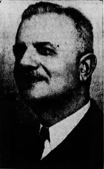
George A. Ades
1845 - 1922
🏗 George A. Ades George A. Ades, a Greek immigrant active in Grants by 1908, emerged as one of the most influential commercial and civic figures in the early development of the Grants–Milan region. Unlike many early settlers whose livelihoods were tied directly to the railroad, ranching, or mining industries, Ades established himself as a builder, merchant, and commercial strategist. Through property acquisition, construction, and infrastructure control, he positioned himself at the center of the town’s evolving business corridor along Santa Fe Avenue. His influence was not limited to a single structure or enterprise. Instead, Ades operated across multiple levels of development — land ownership, building construction, tenant placement, and utility control — forming what can best be understood as an interconnected commercial network spanning several blocks of the town. 🔷 Early Foundations & The Latham Connection Before the Yucca Hotel defined the corner of 1100 W. Santa Fe Avenue, the site was occupied by the Latham family’s Stockman’s Store, one of the earliest known commercial establishments in Grants. This establishes a direct and traceable lineage of development: Latham → Stockman’s Store → Parcel Transfer → Ades → Yucca Hotel The transfer of this property to Ades represents more than a simple land transaction. It reflects a shift in the structure of the local economy — from early, small-scale frontier commerce to more organized and strategically developed commercial space. Through this acquisition, Ades became directly tied to the earliest established business footprint on the block, anchoring his later developments in the town’s foundational history. 🔷 Construction of the Yucca Hotel (1909–1911) In 1909, Ades began construction of the Yucca Hotel, completing and opening it in 1910. At a time when much of Grants was still characterized by temporary wood-frame structures, the Yucca represented one of the first substantial and permanent commercial buildings in the town. By 1911, the first confirmed manager, Katzung, appears in the historical record — correcting a long-standing gap in documentation surrounding the hotel’s early operation. The Yucca was not simply a place of lodging. It functioned as a central hub of activity, combining hospitality, commerce, transportation services, and professional offices within a single structure. This type of multi-use design would become a defining characteristic of the corridor as it developed. 🔷 Effie Ades & The Yucca Café A critical yet often overlooked figure in the operation of the Yucca was Effie Ades, George’s wife, who managed the Yucca Café. Under her direction, the café became a central gathering place within the building and the broader community. The café served railroad workers, miners, travelers, and local residents, reinforcing the Yucca’s role as both a commercial and social center. Effie’s presence highlights the importance of family-operated enterprise in early Grants and places her at the core of the building’s daily life and identity. 🔷 The Yucca as a Multi-Use Structure The Yucca Hotel exemplified a fully integrated commercial building. Its ground floor housed a range of businesses and services, including retail shops, communication offices, and transportation functions such as ticketing and baggage handling. Above, the second floor contained professional offices, including a physician and dentist. This vertical integration of services reflects a practical and efficient use of space, allowing a single building to meet multiple needs within the growing town. It also demonstrates how early commercial structures in Grants were designed not just for occupancy, but for functionality within a larger system. 🔷 White Arrow Garage (1913) In 1913, Ades expanded his influence into the emerging automobile economy with the construction of the White Arrow Garage. As one of the earliest automobile service facilities in the region, it marked a clear transition from wagon-based transportation to motor vehicle use. This development demonstrates Ades’s ability to recognize and respond to technological and economic shifts. By investing in infrastructure that supported automobiles, he positioned his properties and businesses to remain relevant as transportation patterns changed. 🔷 Infrastructure & Civic Leadership Ades’s role in Grants extended beyond buildings into essential infrastructure. By 1928, he controlled the water system that supplied many of his properties and other buildings along Santa Fe Avenue. At the same time, Carroll Gunderson established electrical service within the town. Together, these privately controlled systems provided the foundation for modern commercial operations. Reliable water and electrical service made it possible to support theaters, hotels, retail businesses, and professional services at a scale that had not previously been possible. In addition to his commercial and infrastructural influence, Ades served as mayor, participating directly in the town’s early civic organization and development. 🔷 The Ades Commercial Network (1000–1100 W. Santa Fe) Ades’s developments along Santa Fe Avenue formed an interconnected network rather than a series of independent buildings. Concentrated primarily between the 1000 and 1100 blocks, this network included: Yucca Hotel (1909–1944) White Arrow Garage (1913) Grants Theater Lux Theatre (opened 1937) Carridine’s Drug Store Grants State Bank These properties functioned collectively as a commercial ecosystem, supporting one another through proximity, shared infrastructure, and overlapping clientele. This pattern of development represents one of the earliest examples of coordinated, multi-business planning in Grants. 🔷 Sale of the Yucca & Final Years In 1944, Ades sold the Yucca Hotel to Paul Drake, marking the end of his direct involvement with the building that had defined much of his early work. Two years later, on May 1, 1946, George A. Ades passed away. By the time of his death, the commercial corridor he helped establish had become a central feature of Grants, influencing both its economic activity and physical layout. 🔷 Demolition of the Yucca (1966) The Yucca Hotel was demolished in 1966 during a period when redevelopment trends often favored modernization over preservation. The removal of the building erased a key architectural anchor of the corridor, though its historical significance remains central to understanding the development of the area. 🔷 Legacy George A. Ades stands as a foundational figure in the development of modern Grants. His influence extends across multiple areas: Architectural development Commercial planning and business placement Civic leadership Infrastructure control (water systems) Multi-block commercial expansion More importantly, his work illustrates how the town developed not through isolated efforts, but through a network of interconnected people, properties, and services. This biography restores that network — a layered history that connects individuals, buildings, and infrastructure into a single, continuous story. Early Foundations & The Latham Connection Before the Yucca Hotel existed, the corner lot at 1100 W. Santa Fe Avenue was home to the Latham family’s Stockman’s Store. This establishes a direct lineage: Latham → Stockman’s Store → Parcel Transfer → Ades → Yucca Hotel Ades’s acquisition of Latham property represents a transfer of early commercial power and ties him to the earliest documented business footprint on the block. Construction of the Yucca Hotel (1909–1911) Ades began construction of the Yucca Hotel in 1909, completing and opening it in 1910. This was one of the first substantial, permanent commercial structures in Grants. The first confirmed manager, Katzung, appears in records by 1911, correcting decades of missing or misattributed history. The Yucca was not just a hotel — it was the first major architectural statement in downtown Grants, signaling a shift from frontier commerce to structured urban development. Effie Ades & The Yucca Café A nearly forgotten but critical fact: Effie Ades, George’s wife, managed the Yucca Café. Her work made the hotel a social hub for locals, travelers, railroad workers, and miners. This places Effie at the heart of the Yucca’s daily life and community identity. White Arrow Garage (1913) In 1913, Ades built the White Arrow Garage, one of the earliest automobile‑era service centers in the region. This marks Grants’ transition from wagon‑era commerce to the motor age and establishes Ades as a forward‑thinking builder aligned with technological change. Infrastructure & Civic Leadership Ades played a role in the 1928 power connection, helping bring modern electrical infrastructure to Grants. He also served as mayor, guiding the town through a period of early municipal development. The Ades Commercial Ecosystem (1000–1100 W. Santa Fe) Ades’s influence extended across multiple properties and businesses, forming a corridor‑wide commercial ecosystem that included: White Arrow Garage (1913) Carridine’s Drug Store Grants State Bank Grants Theater Lux Theatre (opened 1937) Yucca Hotel (1909–1944) This interconnected block represents one of the earliest multi‑business commercial clusters in Grants — and Ades was at its center. Sale of the Yucca & Final Years Ades sold the Yucca Hotel to Paul Drake in 1944. He passed away on May 1, 1946, leaving behind a legacy that shaped the architectural, commercial, and civic identity of Grants. Demolition of the Yucca (1966) The Yucca Hotel was demolished in 1966, a casualty of mid‑century redevelopment trends that favored parking lots and low‑rise structures over historic preservation. Its loss erased the physical anchor of the block — but not the history. Legacy George A. Ades stands as a founder of the modern commercial identity of Grants, with influence spanning: architecture business development civic leadership infrastructure modernization multi‑block commercial lineage This biography restores the full, interconnected story — much of which was never documented, never taught, and nearly lost.

Joesph "Joe" Cappelli
1880 - 1973
🏗 Joseph “Joe” Capelli Joseph “Joe” Capelli was an Italian-born stonemason and contractor who played a direct and physical role in shaping early Grants during its first major period of development. Working in close association with George A. Ades, Capelli was responsible for constructing some of the town’s earliest permanent commercial structures, helping transform Grants from a railroad siding into an established and functioning town. Capelli lived only a few blocks from the downtown corridor, placing him within the same environment he was actively building. His work took place during a critical period of transition, when early wood-frame structures were being replaced or supplemented by more durable construction methods capable of supporting long-term commercial growth. 🔷 Early Role in Grants & Construction Work Capelli emerged as one of the primary craftsmen during the early development of Santa Fe Avenue. While many early structures in Grants were temporary and quickly built to meet immediate needs, Capelli’s work reflects a shift toward permanence and structural stability. As a stonemason, his role went beyond simple construction. He provided the technical knowledge required to build foundations, walls, and structural elements that could withstand both time and environmental conditions. This was especially important in a town that would later experience destructive events such as the Great Fire of 1936, which exposed the weaknesses of earlier wood-frame construction. 🔷 Construction of the Yucca Hotel (1909–1911) Capelli is most closely associated with the construction of the Yucca Hotel, built for George A. Ades between 1909 and 1911 on the former site of Latham’s Stockman’s Store. This project represents one of the earliest substantial commercial builds in Grants and marked a turning point in how buildings were constructed within the town. The Yucca required coordinated effort between land acquisition, planning, and construction. Ades acted as the developer and organizer, while Capelli executed the physical construction. The result was a multi-use commercial structure that combined lodging, retail, transportation services, and professional offices within a single building. This project set a precedent for future development along Santa Fe Avenue, both in terms of function and construction quality. 🔷 Expansion Along Santa Fe Avenue Following the Yucca Hotel, Capelli continued to work on additional structures as development expanded westward along Santa Fe Avenue. His work became a consistent feature across multiple properties, particularly those associated with Ades’s growing commercial footprint. Buildings constructed during this period reflect: a shift toward masonry-supported construction more durable and permanent design increased investment in long-term commercial use Through repeated collaboration, Capelli and Ades contributed to the formation of a connected commercial corridor, rather than isolated individual buildings. 🔷 Construction Methods & Materials A defining aspect of Capelli’s work was the use of locally sourced materials, particularly malpais basalt. This material was widely used for foundations and structural elements, providing increased durability and resistance compared to earlier construction methods. Capelli’s masonry work helped establish a recognizable structural standard in Grants. Even as architectural styles varied, the underlying construction methods reflected a consistent approach to building that emphasized longevity. 🔷 Role Within the Development Network Within the broader development of Santa Fe Avenue, Capelli functioned as the primary builder responsible for turning plans into physical reality. His work was directly tied to the expansion of Ades’s properties and the growth of the commercial corridor. Their working relationship can be understood as a structured system: George A. Ades → land acquisition, development, infrastructure control Joseph Capelli → construction, masonry, structural execution This partnership allowed for coordinated growth across multiple blocks, creating a network of buildings that supported one another through shared location, function, and infrastructure. 🔷 Connection to Early Development (100 Block) Capelli’s work is also connected to the earlier development phase of the 100 block, where initial wood-frame buildings such as the Woodard Hotel, Grants Drug, and Whiteside Hotel & Café were constructed. While these structures represented an earlier stage of development, they formed the foundation upon which later, more permanent construction would expand. The transition from these early buildings to later masonry-supported structures reflects the broader evolution of Grants from a temporary railroad settlement into a more stable and organized commercial town. 🔷 Legacy Joseph “Joe” Capelli’s legacy is embedded in the physical construction of early Grants. His work represents the transition from temporary to permanent building practices and helped define the structural foundation of the town’s commercial corridor. Through his continued collaboration with George A. Ades, Capelli contributed to the development of a multi-block commercial system that supported businesses, services, and daily life for decades. While many of these structures have since been altered or removed, the impact of his craftsmanship remains central to understanding how Grants developed. More importantly, Capelli’s role illustrates that the growth of Grants was not driven by a single figure, but by a network of individuals whose combined efforts shaped the town. His work forms a critical part of that network, linking construction, commerce, and infrastructure into a unified historical narrative.



1931
Grants — Carrot Capital of the World


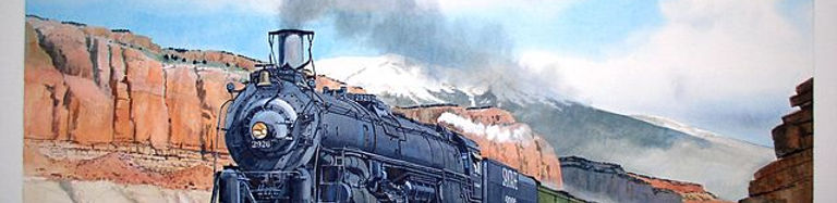
Grants Cut and Mt. Taylor
Locomotive 2926 heading west through
Grants Cut

Elevation: 6,460 ft | Population: 2,010
1931 - 1949
THE INLAND UTILITIES CO.
The Mother Road
Will Rogers Highway

Owner: The Inland Utilities Co. of Kansas
Manager:
Phone: 12
1927 — Yucca Hotel Expands Services
By 1927, the Yucca Hotel had become one of Grants’ most reliable lodging houses, offering meals, rooms, and traveler accommodations during the early years of Route 66. Local directory listings from this period show the hotel advertising steady service and dependable management, reflecting its growing role as a community anchor before the major highway boom of the 1930s.
A 1927 directory entry highlights the Yucca Hotel’s early reputation for consistent service and traveler accommodations.
Grants Union High School "Pirates Ahoy"
1946 sponsor ad page for
The Inland Utilities Co.
Artifact: 1955 Grants High School "Pirates Ahoy" Sponsor Ad for the LUX Theatre
Source: Shawn Barringer | https://www.facebook.com/share/p/1BESHbmqfu/
Caption:
1931 — Artifact and Visuals
1946
Grants — Carrot Capital of the World
Grants Cut and Mt. Taylor
Locomotive 2926 heading west through
Grants Cut
Elevation: 6,460 ft | Population: 2,280
1931 - 1949
THE INLAND UTILITIES CO.
The Mother Road
Will Rogers Highway
Owner: The Inland Utilities Co. of Kansas
Manager:
Phone: 12
1927 — Yucca Hotel Expands Services
By 1927, the Yucca Hotel had become one of Grants’ most reliable lodging houses, offering meals, rooms, and traveler accommodations during the early years of Route 66. Local directory listings from this period show the hotel advertising steady service and dependable management, reflecting its growing role as a community anchor before the major highway boom of the 1930s.
A 1927 directory entry highlights the Yucca Hotel’s early reputation for consistent service and traveler accommodations.
1946 — The Inland Utilities Co.
Artifact and Visuals
Source: Photographs courtesy of the Kiva Cafe and Elkins Family

Grants Union High School "Pirates Ahoy"
1946 sponsor ad page for
The Inland Utilities Co.
Artifact: 1955 Grants High School "Pirates Ahoy" Sponsor Ad for the LUX Theatre
Source: Shawn Barringer | https://www.facebook.com/share/p/1BESHbmqfu/
Caption:
1947
Grants — Carrot Capital of the World
Grants Cut and Mt. Taylor
Locomotive 2926 heading west through
Grants Cut
Elevation: 6,460 ft | Population: 2,280
1931 - 1949
THE INLAND UTILITIES CO.
The Mother Road
Will Rogers Highway
Owner: The Inland Utilities Co. of Kansas
Manager:
Phone: 12
1927 — Yucca Hotel Expands Services
By 1927, the Yucca Hotel had become one of Grants’ most reliable lodging houses, offering meals, rooms, and traveler accommodations during the early years of Route 66. Local directory listings from this period show the hotel advertising steady service and dependable management, reflecting its growing role as a community anchor before the major highway boom of the 1930s.
A 1927 directory entry highlights the Yucca Hotel’s early reputation for consistent service and traveler accommodations.
1947 — The Inland Utilities Co.
Artifact and Visuals
Source: Photographs courtesy of the Kiva Cafe and Elkins Family

Grants Union High School "Pirates Ahoy"
1947 sponsor ad page for
The Inland Utilities Co.
Artifact: 1955 Grants High School "Pirates Ahoy" Sponsor Ad for the LUX Theatre
Source: Shawn Barringer | https://www.facebook.com/share/p/1BESHbmqfu/
Caption:
1948
Grants — Carrot Capital of the World
Grants Cut and Mt. Taylor
Locomotive 2926 heading west through
Grants Cut
Elevation: 6,460 ft | Population: 2,280
1927 — Yucca Hotel Expands Services
By 1927, the Yucca Hotel had become one of Grants’ most reliable lodging houses, offering meals, rooms, and traveler accommodations during the early years of Route 66. Local directory listings from this period show the hotel advertising steady service and dependable management, reflecting its growing role as a community anchor before the major highway boom of the 1930s.
1948 - 1958
CONTINENTAL DIVIDE
ELECTRIC CO-OP, INC.
The Mother Road
Will Rogers Highway
Owner: Continental Divide Electric Co-op, Inc.
Manager: Lon A. Adams
Phone: 12
A 1927 directory entry highlights the Yucca Hotel’s early reputation for consistent service and traveler accommodations.
1948 — The Inland Utilities Co.
Artifact and Visuals
Source: Photographs courtesy of the Kiva Cafe and Elkins Family
Grants Union High School "Pirates Ahoy"
1946 sponsor ad page for
The Inland Utilities Co.
Artifact: 1955 Grants High School "Pirates Ahoy" Sponsor Ad for the LUX Theatre
Source: Shawn Barringer | https://www.facebook.com/share/p/1BESHbmqfu/
Caption:
1956
Grants — Carrot Capital of the World
Grants Cut and Mt. Taylor
Locomotive 2926 heading west through
Grants Cut
Elevation: 6,460 ft | Population: 7,500


1948 - 1958
CONTINENTAL DIVIDE
ELECTRIC COOPERATIVE, INC.
The Mother Road
Will Rogers Highway
Owner: Continental Divide Electric Co-op, Inc.
Manager: Lon A. Adams
Phone: AT 7 - 4851
1927 — Yucca Hotel Expands Services
By 1927, the Yucca Hotel had become one of Grants’ most reliable lodging houses, offering meals, rooms, and traveler accommodations during the early years of Route 66. Local directory listings from this period show the hotel advertising steady service and dependable management, reflecting its growing role as a community anchor before the major highway boom of the 1930s.
A 1927 directory entry highlights the Yucca Hotel’s early reputation for consistent service and traveler accommodations.
1956— Continental Divide Electric Coop
Artifact and Visuals
Source: Photographs courtesy of the Kiva Cafe and Elkins Family

Continental Divide Electric Coop, Inc.
1956 Grand Opening Photo
Continental Divide Electric Coop, Inc.
1956 Grand Opening Photo
Artifact 1: Continental Divide Electric Cooperative Inc.
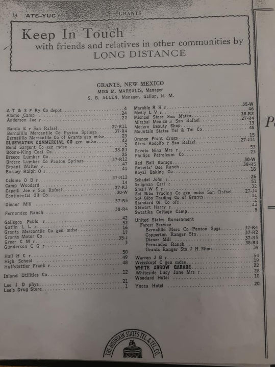
Artifact 2: Mountain States Tel & Tel Co. White Page listings
Source 1: Our History | Continental Divide Electric Cooperative (cdec.coop)
Source 2:
Photo Courtesy: Continental Divide Electric Cooperative Inc.
Caption:
1965
Grants — Carrot Capital of the World
Grants Cut and Mt. Taylor
Locomotive 2926 heading west through
Grants Cut
Elevation: 6,460 ft | Population: 9,400

1948 - 1958
GRANTS CHAMBER OF COMMERCE
The Mother Road
Will Rogers Highway
Owner:
Manager:
Phone: AT 7 - 4851
1927 — Yucca Hotel Expands Services
By 1927, the Yucca Hotel had become one of Grants’ most reliable lodging houses, offering meals, rooms, and traveler accommodations during the early years of Route 66. Local directory listings from this period show the hotel advertising steady service and dependable management, reflecting its growing role as a community anchor before the major highway boom of the 1930s.
A 1927 directory entry highlights the Yucca Hotel’s early reputation for consistent service and traveler accommodations.
1965— Grants Chamber of Commerce
Artifact and Visuals
Source: Photographs courtesy of the Kiva Cafe and Elkins Family

Continental Divide Electric Coop, Inc.
1956 Grand Opening Photo
Artifact 1: Continental Divide Electric Cooperative Inc.
Artifact 2: Mountain States Tel & Tel Co. White Page listings
Source 1: Our History | Continental Divide Electric Cooperative (cdec.coop)
Source 2:
Photo Courtesy: Continental Divide Electric Cooperative Inc.
Caption:
1973
Grants — Carrot Capital of the World
Grants Cut and Mt. Taylor
Locomotive 2926 heading west through
Grants Cut
Elevation: 6,460 ft | Population: 9,620


1948 - 1958
GRANTS - WESTERN VALENCIA COUNTY CHAMBER of COMMERCE
The Mother Road
Will Rogers Highway
Owner:
Manager:
Phone: AT 7 - 4851
1927 — Yucca Hotel Expands Services
By 1927, the Yucca Hotel had become one of Grants’ most reliable lodging houses, offering meals, rooms, and traveler accommodations during the early years of Route 66. Local directory listings from this period show the hotel advertising steady service and dependable management, reflecting its growing role as a community anchor before the major highway boom of the 1930s.
A 1927 directory entry highlights the Yucca Hotel’s early reputation for consistent service and traveler accommodations.
1977— Grants Chamber of Commerce
Artifact and Visuals
Source: Photographs courtesy of the Kiva Cafe and Elkins Family

Continental Divide Electric Coop, Inc.
1956 Grand Opening Photo
Artifact 1: Continental Divide Electric Cooperative Inc.
Artifact 2: Mountain States Tel & Tel Co. White Page listings
Source 1: Our History | Continental Divide Electric Cooperative (cdec.coop)
Source 2:
Photo Courtesy: Continental Divide Electric Cooperative Inc.
Caption:

2026
Grants — Carrot Capital of the World
Grants Cut and Mt. Taylor
Locomotive 2926 heading west through
Grants Cut
Elevation: 6,460 ft | Population: 8,908


1992 - Present
RIVERWALK PARK


The Mother Road
Will Rogers Highway
Owner: City of Grants
Partner: Grants Mainstreet Project, Inc.
Phone:
1927 — Yucca Hotel Expands Services
By 1927, the Yucca Hotel had become one of Grants’ most reliable lodging houses, offering meals, rooms, and traveler accommodations during the early years of Route 66. Local directory listings from this period show the hotel advertising steady service and dependable management, reflecting its growing role as a community anchor before the major highway boom of the 1930s.
A 1927 directory entry highlights the Yucca Hotel’s early reputation for consistent service and traveler accommodations.
2000 — Artifact and Visuals

Continental Divide Electric Coop, Inc.
1956 Grand Opening Photo

Artifact 1: Continental Divide Electric Cooperative Inc.
Artifact 2: Mountain States Tel & Tel Co. White Page listings
Source 1: Our History | Continental Divide Electric Cooperative (cdec.coop)
Source 2:
Photo Courtesy: Continental Divide Electric Cooperative Inc.
Caption:
Downtown Grants
501 W. Santa Fe Avenue
at Fifth Street
Route Shields of Grants-Milan and
surrounding areas on or connecting to
Historic US Route 66
1912-1926
1912-1926
1926-1948
1948-1961
1961-1971
1971-1985
1912-1927
1927-Present
1972-Present
1988-Present
1951-Present
1985-Present
1985-Present
1985-Present
1991-Present
1998-Present
1998-Present
2010-Present
Modern Cleaners & Dryers Parcel
1973
Grants — Carrot Capital of the World
Grants Cut and Mt. Taylor
Locomotive 2926 heading west through
Grants Cut
Elevation: 6,460 ft | Population: 9,620
2011 - 2012
CAR WASH
The Mother Road
Will Rogers Highway
Owner:
Manager:
Phone: AT 7
1927 — Yucca Hotel Expands Services
By 1927, the Yucca Hotel had become one of Grants’ most reliable lodging houses, offering meals, rooms, and traveler accommodations during the early years of Route 66. Local directory listings from this period show the hotel advertising steady service and dependable management, reflecting its growing role as a community anchor before the major highway boom of the 1930s.
A 1927 directory entry highlights the Yucca Hotel’s early reputation for consistent service and traveler accommodations.
1973— Car Wash
Artifact and Visuals
Source: Photographs courtesy of the Kiva Cafe and Elkins Family
Grants High School "Pirates Ahoy"
1969 sponsor ad section for the
Lux Theatre
Artifact: 1955 Grants High School "Pirates Ahoy" Sponsor Ad for the LUX Theatre
Source: Shawn Barringer | https://www.facebook.com/share/p/1BESHbmqfu/
Caption:
1992 - Present
RIVERWALK PARK
The Mother Road
Will Rogers Highway
Owner: City of Grants
Partner: Grants Mainstreet Project, Inc.
Phone:
1927 — Yucca Hotel Expands Services
By 1927, the Yucca Hotel had become one of Grants’ most reliable lodging houses, offering meals, rooms, and traveler accommodations during the early years of Route 66. Local directory listings from this period show the hotel advertising steady service and dependable management, reflecting its growing role as a community anchor before the major highway boom of the 1930s.
A 1927 directory entry highlights the Yucca Hotel’s early reputation for consistent service and traveler accommodations.
2000— Riverwalk Park
Artifact and Visuals
Source: Photographs courtesy of the Kiva Cafe and Elkins Family
Continental Divide Electric Coop, Inc.
1956 Grand Opening Photo
Artifact 1: Continental Divide Electric Cooperative Inc.
Artifact 2: Mountain States Tel & Tel Co. White Page listings
Source 1: Our History | Continental Divide Electric Cooperative (cdec.coop)
Source 2:
Photo Courtesy: Continental Divide Electric Cooperative Inc.
Caption:
2025
Grants — Carrot Capital of the World
Grants Cut and Mt. Taylor
Locomotive 2926 heading west through
Grants Cut
Elevation: 6,460 ft | Population: 8,908
1992 - Present
RIVERWALK PARK
The Mother Road
Will Rogers Highway
Owner: City of Grants
Partner: Grants Mainstreet Project, Inc.
Phone:
1927 — Yucca Hotel Expands Services
By 1927, the Yucca Hotel had become one of Grants’ most reliable lodging houses, offering meals, rooms, and traveler accommodations during the early years of Route 66. Local directory listings from this period show the hotel advertising steady service and dependable management, reflecting its growing role as a community anchor before the major highway boom of the 1930s.
A 1927 directory entry highlights the Yucca Hotel’s early reputation for consistent service and traveler accommodations.
2025— Riverwalk Park
Artifact and Visuals
Source: Photographs courtesy of the Kiva Cafe and Elkins Family

Continental Divide Electric Coop, Inc.
1956 Grand Opening Photo
Artifact 1: Continental Divide Electric Cooperative Inc.
Artifact 2: Mountain States Tel & Tel Co. White Page listings
Source 1: Our History | Continental Divide Electric Cooperative (cdec.coop)
Source 2:
Photo Courtesy: Continental Divide Electric Cooperative Inc.
Caption:
Downtown Grants
502 W. Santa Fe Avenue
1912-1926
1912-1926
1926-1948
1948-1961
1961-1971
1971-1985
1912-1927
1927-Present
1972-Present
1985-Present
1951-Present
1985-Present
1985-Present
1985-Present
1991-Present
1998-Present
1998-Present
2010-Present
George Ades Parcel
The building at 110 W. Santa Fe Avenue was constructed in the late 1960s on the west end of the former Tropical Lounge/California Bar parcel. This subdivision occurred before the bar was demolished, and the new structure appears in late‑1960s photographs of the California Bar.
The first documented tenant was Pacific Finance, which relocated here by 1973 after previously operating at 807 W. Santa Fe Avenue in 1966, 1967, and 1968. Over the next five decades, the building housed a sequence of small professional, retail, and service businesses that reflect the changing needs of Grants residents as Santa Fe Avenue transitioned from a Route 66 travel corridor into a locally focused business district.
Route Shields of Grants-Milan and
surrounding areas on or connecting to
Historic US Route 66
The development of 110 W. Santa Fe reflects the final wave of mid‑century infill along the 100 block, providing new commercial space as Grants expanded and diversified.
1976
Grants — Carrot Capital of the World
Grants Cut and Mt. Taylor
Locomotive 2926 heading west through
Grants Cut
Elevation: 6,460 ft | Population: 9,620
GEORGE ADES
1910 - 1929
Owner: George Ades
Manager: None
Phone: None
1927 — Yucca Hotel Expands Services
By 1927, the Yucca Hotel had become one of Grants’ most reliable lodging houses, offering meals, rooms, and traveler accommodations during the early years of Route 66. Local directory listings from this period show the hotel advertising steady service and dependable management, reflecting its growing role as a community anchor before the major highway boom of the 1930s.
A 1927 directory entry highlights the Yucca Hotel’s early reputation for consistent service and traveler accommodations.
1910— George Ades
Artifacts and Visuals
Source: Photographs courtesy of the Kiva Cafe and Elkins Family
Grants High School "Pirates Ahoy"
1969 sponsor ad section for the
Lux Theatre
Artifact: 1955 Grants High School "Pirates Ahoy" Sponsor Ad for the LUX Theatre
Source: Shawn Barringer | https://www.facebook.com/share/p/1BESHbmqfu/
Caption:
1929
Grants — Carrot Capital of the World
Grants Cut and Mt. Taylor
Locomotive 2926 heading west through
Grants Cut
Elevation: 6,460 ft | Population: 2,010
1927 — Yucca Hotel Expands Services
By 1927, the Yucca Hotel had become one of Grants’ most reliable lodging houses, offering meals, rooms, and traveler accommodations during the early years of Route 66. Local directory listings from this period show the hotel advertising steady service and dependable management, reflecting its growing role as a community anchor before the major highway boom of the 1930s.
A 1927 directory entry highlights the Yucca Hotel’s early reputation for consistent service and traveler accommodations.
1929 — Mountain States Tel & Tel Co.
Artifacts and Visuals
Source: Photographs courtesy of the Kiva Cafe and Elkins Family

Mountain States Tel & Tel Co.
June 1929
Grants first Telephone Co.

Mountain States Tel & Tel Co.
June 1929
Mountain States Tel & Tel Co. Picnic
(Transportation provided by - Breece Lumber Co. of Grants, New Mexico
Artifact: 1955 Grants High School "Pirates Ahoy" Sponsor Ad for the LUX Theatre
Source: Shawn Barringer | https://www.facebook.com/share/p/1BESHbmqfu/
Caption:
1931 - 1949

MOUNTAIN STATES
TEL & TEL CO.
The Mother Road
Will Rogers Highway
Owner: Mountain States Tel & Tel Co., Denver, Colorado
Manager:
Phone: 45
Downtown Grants
504 W. Santa Fe Avenue
1912-1926
1912-1926
1926-1948
1948-1961
1961-1971
1971-1985
1912-1927
1927-Present
1972-Present
1985-Present
1951-Present
1985-Present
1985-Present
1985-Present
1991-Present
1998-Present
1998-Present
2010-Present
Richard Mace Parcel
The building at 110 W. Santa Fe Avenue was constructed in the late 1960s on the west end of the former Tropical Lounge/California Bar parcel. This subdivision occurred before the bar was demolished, and the new structure appears in late‑1960s photographs of the California Bar.
The first documented tenant was Pacific Finance, which relocated here by 1973 after previously operating at 807 W. Santa Fe Avenue in 1966, 1967, and 1968. Over the next five decades, the building housed a sequence of small professional, retail, and service businesses that reflect the changing needs of Grants residents as Santa Fe Avenue transitioned from a Route 66 travel corridor into a locally focused business district.
Route Shields of Grants-Milan and
surrounding areas on or connecting to
Historic US Route 66
The development of 110 W. Santa Fe reflects the final wave of mid‑century infill along the 100 block, providing new commercial space as Grants expanded and diversified.
RICHARD MACE
1910 - 1929
Owner: George Ades
Manager: None
Phone: None
1927 — Yucca Hotel Expands Services
By 1927, the Yucca Hotel had become one of Grants’ most reliable lodging houses, offering meals, rooms, and traveler accommodations during the early years of Route 66. Local directory listings from this period show the hotel advertising steady service and dependable management, reflecting its growing role as a community anchor before the major highway boom of the 1930s.
A 1927 directory entry highlights the Yucca Hotel’s early reputation for consistent service and traveler accommodations.
1910— Richard Mace
Artifacts and Visuals
Source: Photographs courtesy of the Kiva Cafe and Elkins Family
Grants High School "Pirates Ahoy"
1969 sponsor ad section for the
Lux Theatre
Artifact: 1955 Grants High School "Pirates Ahoy" Sponsor Ad for the LUX Theatre
Source: Shawn Barringer | https://www.facebook.com/share/p/1BESHbmqfu/
Caption:
Downtown Grants
519 W. Santa Fe Avenue
Route Shields of Grants-Milan and
surrounding areas on or connecting to
Historic US Route 66
1912-1926
1912-1926
1926-1948
1948-1961
1961-1971
1971-1985
1912-1927
1927-Present
1972-Present
1985-Present
1951-Present
1985-Present
1985-Present
1985-Present
1991-Present
1998-Present
1998-Present
2010-Present
Thigpen's General Store & Builders Supply Parcel
The building at 110 W. Santa Fe Avenue was constructed in the late 1960s on the west end of the former Tropical Lounge/California Bar parcel. This subdivision occurred before the bar was demolished, and the new structure appears in late‑1960s photographs of the California Bar.
The first documented tenant was Pacific Finance, which relocated here by 1973 after previously operating at 807 W. Santa Fe Avenue in 1966, 1967, and 1968. Over the next five decades, the building housed a sequence of small professional, retail, and service businesses that reflect the changing needs of Grants residents as Santa Fe Avenue transitioned from a Route 66 travel corridor into a locally focused business district.
The development of 110 W. Santa Fe reflects the final wave of mid‑century infill along the 100 block, providing new commercial space as Grants expanded and diversified.
1926
Grants — Carrot Capital of the World
Grants Cut and Mt. Taylor
Locomotive 2926 heading west through
Grants Cut
Elevation: 6,460 ft | Population: 2,280
2005 - 2010
THIGPEN'S GENERAL STORE
& BUILDING SUPPLY
The Mother Road
Will Rogers Highway
Owner: Thigpen
Manager:
Phone:
1927 — Yucca Hotel Expands Services
By 1927, the Yucca Hotel had become one of Grants’ most reliable lodging houses, offering meals, rooms, and traveler accommodations during the early years of Route 66. Local directory listings from this period show the hotel advertising steady service and dependable management, reflecting its growing role as a community anchor before the major highway boom of the 1930s.
A 1927 directory entry highlights the Yucca Hotel’s early reputation for consistent service and traveler accommodations.
1926— Thigpen's General Store
& Building Supply
Artifacts and Visuals
Source: Photographs courtesy of the Kiva Cafe and Elkins Family
Grants High School "Pirates Ahoy"
1969 sponsor ad section for the
Lux Theatre
Grants High School "Pirates Ahoy"
1969 sponsor ad section for the
Lux Theatre
Artifact: 1955 Grants High School "Pirates Ahoy" Sponsor Ad for the LUX Theatre
Source: Shawn Barringer | https://www.facebook.com/share/p/1BESHbmqfu/
Caption:
1947
Grants — Carrot Capital of the World
Grants Cut and Mt. Taylor
Locomotive 2926 heading west through
Grants Cut
Elevation: 6,460 ft | Population: 2,280
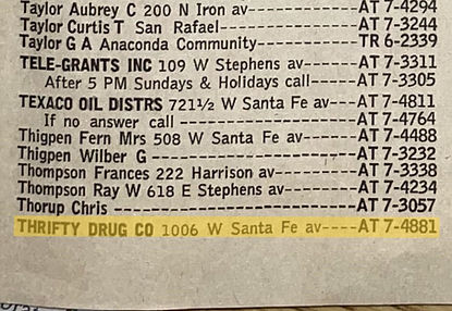
THRIFTY DRUG CO.
1946 - 197x
Owner: Carolyn Hendrix
Manager: Tom Cody
Phone: 287-8434
1927 — Yucca Hotel Expands Services
By 1927, the Yucca Hotel had become one of Grants’ most reliable lodging houses, offering meals, rooms, and traveler accommodations during the early years of Route 66. Local directory listings from this period show the hotel advertising steady service and dependable management, reflecting its growing role as a community anchor before the major highway boom of the 1930s.
A 1927 directory entry highlights the Yucca Hotel’s early reputation for consistent service and traveler accommodations.
1947— Abe's Liquor Store
Grants, New Mexico
Source: Photographs courtesy of the Kiva Cafe and Elkins Family
Grants High School "Pirates Ahoy"
1969 sponsor ad section for the
Lux Theatre
Grants High School "Pirates Ahoy"
1969 sponsor ad section for the
Lux Theatre
Artifact: 1955 Grants High School "Pirates Ahoy" Sponsor Ad for the LUX Theatre
Source: Shawn Barringer | https://www.facebook.com/share/p/1BESHbmqfu/
Caption:
1956
Grants — Carrot Capital of the World
Grants Cut and Mt. Taylor
Locomotive 2926 heading west through
Grants Cut
Elevation: 6,460 ft | Population: 7,500
19XX - 1956
GRANTS BUILDERS SUPPLY
The Mother Road
Will Rogers Highway
Owner: Thigpen
Manager:
Phone: AT 7 - 4222
1927 — Yucca Hotel Expands Services
In 1956 Eugene Woo opens a cafe located at 519 W. Santa Fe Ave (W. Highway 66). The cafe is to be named after Grants, New Mexico's booming industry of uranium mining, when uranium was found by local Navajo sheepherder Paddy Martinez in 1950. So, in honor of the industry the cafe became known as the Uranium Cafe. The cafe is to serve Chinese - American Foods.
A 1927 directory entry highlights the Yucca Hotel’s early reputation for consistent service and traveler accommodations.
1956— Grants Builders Supply
Artifacts and Visuals
Source: Photographs courtesy of the Kiva Cafe and Elkins Family

Grants High School "Pirates Ahoy"“Men walking outside Uranium Cafe, Grants, New Mexico, 1956 (Photo by J.R. Eyerman/The LIFE Picture Collection via Getty Images)”

Grants High School "Pirates Ahoy"
1969 sponsor ad section for the
Lux Theatre
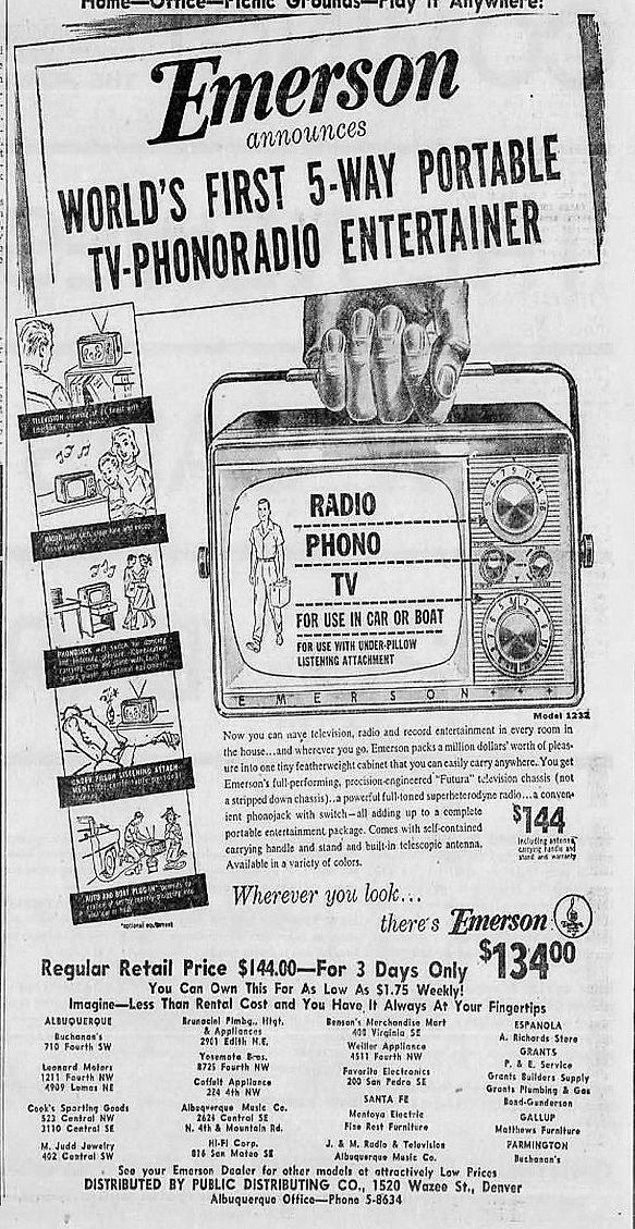
Artifact: 1955 Grants High School "Pirates Ahoy" Sponsor Ad for the LUX Theatre
Source: Pirates ahoy : Grants High School (Grants, N.M.) : Free Download, Borrow, and Streaming : Internet Archive
Caption:
Grants High School "Pirates Ahoy"
1969 sponsor ad section for the
Lux Theatre

1956 - 19xx
URANIUM CAFE
The Mother Road
Will Rogers Highway
Owner: Eugene Woo
Manager:
Phone: AT 7 - 4456
1927 — Yucca Hotel Expands Services
In 1956 Eugene Woo opens a cafe located at 519 W. Santa Fe Ave (W. Highway 66).
The cafe is to be named after Grants, New Mexico's booming industry of uranium mining, when uranium was found by local Navajo sheepherder Paddy Martinez in 1950. So, in honor of the industry the cafe became known as the Uranium Cafe.
The cafe is to serve Chinese - American Foods.
A 1927 directory entry highlights the Yucca Hotel’s early reputation for consistent service and traveler accommodations.
1956— Uranium Cafe
Artifacts and Visuals
Source: Photographs courtesy of the Kiva Cafe and Elkins Family

Grants High School "Pirates Ahoy"
“Men walking outside Uranium Cafe, Grants, New Mexico, 1956 (Photo by J.R. Eyerman/The LIFE Picture Collection via Getty Images)”

1956 - Uranium Cafe
More Uranium Ore at Uranium Cafe

1956 - Uranium Cafe
Displaying of Uranium Ore at Uranium Cafe
Mountain States Tel & Tel Co.
1956 White Page listing for
Uranium Cafe

Uranium Cafe
1956 Matchbook cover
by the Monarch Match Co. San Jose, California
Artifact: 1955 Grants High School "Pirates Ahoy" Sponsor Ad for the LUX Theatre
Source: Shawn Barringer | https://www.facebook.com/share/p/1BESHbmqfu/
Caption:
1958
Grants — Carrot Capital of the World
Grants Cut and Mt. Taylor
Locomotive 2926 heading west through
Grants Cut
Elevation: 6,460 ft | Population: 7,500
1956 - 19xx
URANIUM CAFE
The Mother Road
Will Rogers Highway
Owner: Eugene Woo and Yee Kwong
Manager:
Phone: 287- 3940
1927 — Yucca Hotel Expands Services
By 1927, the Yucca Hotel had become one of Grants’ most reliable lodging houses, offering meals, rooms, and traveler accommodations during the early years of Route 66. Local directory listings from this period show the hotel advertising steady service and dependable management, reflecting its growing role as a community anchor before the major highway boom of the 1930s.
A 1927 directory entry highlights the Yucca Hotel’s early reputation for consistent service and traveler accommodations.

This Is Grants
1958 brochure ad for
Uranium Cafe


1958 - Uranium Cafe
The Vault of the Atomic Space Age
Artifact: 1958 "This is Grants" Brochure Ad for the Uranium Cafe
Source 1: Patricia McClure | https://www.facebook.com/share/p/1BESHbmqfu/
Source 2: The Vault of the Atomic Age | https://www.facebook.com/profile/100064567065204/search?q=Uranium%20Cafe
Caption:
1958 — Artifacts and Visuals
1964
Grants — Carrot Capital of the World
Grants Cut and Mt. Taylor
Locomotive 2926 heading west through
Grants Cut
Elevation: 6,460 ft | Population: 9,400
1956 - 19xx
URANIUM CAFE
The Mother Road
Will Rogers Highway
Owner: Eugene Woo and Yee Kwong
Manager:
Phone: AT 7- 3940
1927 — Yucca Hotel Expands Services
By 1927, the Yucca Hotel had become one of Grants’ most reliable lodging houses, offering meals, rooms, and traveler accommodations during the early years of Route 66. Local directory listings from this period show the hotel advertising steady service and dependable management, reflecting its growing role as a community anchor before the major highway boom of the 1930s.

Grants High School "Pirates Ahoy"
1964 sponsor ad section for the
Uranium Cafe
Artifact: 1955 Grants High School "Pirates Ahoy" Sponsor Ad for the LUX Theatre
Source: Patricia McClure | https://www.facebook.com/share/p/1BESHbmqfu/
Caption:
1964 — Artifacts and Visuals
A 1927 directory entry highlights the Yucca Hotel’s early reputation for consistent service and traveler accommodations.
1966
Grants — Carrot Capital of the World
Grants Cut and Mt. Taylor
Locomotive 2926 heading west through
Grants Cut
Elevation: 6,460 ft | Population: 9,400
1956 - 19xx
URANIUM CAFE
The Mother Road
Will Rogers Highway
Owner: Eugene Woo and Yee Kwong
Manager:
Phone: 287- 3940
1927 — Yucca Hotel Expands Services
By 1927, the Yucca Hotel had become one of Grants’ most reliable lodging houses, offering meals, rooms, and traveler accommodations during the early years of Route 66. Local directory listings from this period show the hotel advertising steady service and dependable management, reflecting its growing role as a community anchor before the major highway boom of the 1930s.
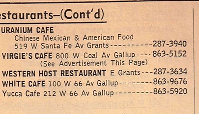
Grants High School "Pirates Ahoy"
1969 sponsor ad section for the
Lux Theatre
Artifact: 1955 Grants High School "Pirates Ahoy" Sponsor Ad for the LUX Theatre
Source: Patricia McClure | https://www.facebook.com/share/p/1BESHbmqfu/
Caption:
1966 — Artifacts and Visuals
A 1927 directory entry highlights the Yucca Hotel’s early reputation for consistent service and traveler accommodations.
1968
Grants — Carrot Capital of the World
Grants Cut and Mt. Taylor
Locomotive 2926 heading west through
Grants Cut
Elevation: 6,460 ft | Population: 9,400
1956 - 19xx
URANIUM CAFE
The Mother Road
Will Rogers Highway
Owner: Eugene Woo and Yee Kwong
Manager:
Phone: 287- 3940
1927 — Yucca Hotel Expands Services
By 1927, the Yucca Hotel had become one of Grants’ most reliable lodging houses, offering meals, rooms, and traveler accommodations during the early years of Route 66. Local directory listings from this period show the hotel advertising steady service and dependable management, reflecting its growing role as a community anchor before the major highway boom of the 1930s.
A 1927 directory entry highlights the Yucca Hotel’s early reputation for consistent service and traveler accommodations.
1968— Uranium Cafe
Artifacts and Visuals
Source: Photographs courtesy of the Kiva Cafe and Elkins Family

Grants High School "Pirates Ahoy"
1969 sponsor ad section for the
Lux Theatre
Artifact: 1955 Grants High School "Pirates Ahoy" Sponsor Ad for the LUX Theatre
Source: Patricia McClure
https://www.facebook.com/CibolaCountyHistoricalSociety/photos/a.531816991992548/556120676228846/?type=3
Caption:
1969
Grants — Carrot Capital of the World
Grants Cut and Mt. Taylor
Locomotive 2926 heading west through
Grants Cut
Elevation: 6,460 ft | Population: 9,400
1956 - 19xx
URANIUM CAFE
The Mother Road
Will Rogers Highway
Owner: Eugene Woo and Yee Kwong
Manager:
Phone: 287- 3940
1927 — Yucca Hotel Expands Services
By 1927, the Yucca Hotel had become one of Grants’ most reliable lodging houses, offering meals, rooms, and traveler accommodations during the early years of Route 66. Local directory listings from this period show the hotel advertising steady service and dependable management, reflecting its growing role as a community anchor before the major highway boom of the 1930s.
1969— Uranium Cafe
Artifacts and Visuals
Source: Photographs courtesy of the Kiva Cafe and Elkins Family

Grants High School "Pirates Ahoy"
1969 sponsor ad section for the
Uranium Cafe
Artifact: 1955 Grants High School "Pirates Ahoy" Sponsor Ad for the LUX Theatre
Source: Patricia McClure
https://www.facebook.com/CibolaCountyHistoricalSociety/photos/a.531816991992548/556120676228846/?type=3
Caption:
A 1927 directory entry highlights the Yucca Hotel’s early reputation for consistent service and traveler accommodations.
1979
Grants — Carrot Capital of the World
Grants Cut and Mt. Taylor
Locomotive 2926 heading west through
Grants Cut
Elevation: 6,460 ft | Population: 10,830
1956 - 19xx
URANIUM CAFE
"DOS PONCHOS"
The Mother Road
Will Rogers Highway
Owner: Eugene Woo and Yee Kwong
Manager:
Phone: 287- 3940
1927 — Yucca Hotel Expands Services
By 1927, the Yucca Hotel had become one of Grants’ most reliable lodging houses, offering meals, rooms, and traveler accommodations during the early years of Route 66. Local directory listings from this period show the hotel advertising steady service and dependable management, reflecting its growing role as a community anchor before the major highway boom of the 1930s.
A 1927 directory entry highlights the Yucca Hotel’s early reputation for consistent service and traveler accommodations.
1979— Uranium Cafe
Artifacts and Visuals
Source: Photographs courtesy of the Kiva Cafe and Elkins Family

Grants High School "Pirates Ahoy"
1969 sponsor ad section for the
Uranium Cafe

Grants High School "Pirates Ahoy"
1969 sponsor ad section for the
Uranium Cafe
Artifact: 1955 Grants High School "Pirates Ahoy" Sponsor Ad for the LUX Theatre
Source: Patricia McClure
https://www.facebook.com/CibolaCountyHistoricalSociety/photos/a.531816991992548/556120676228846/?type=3
Caption:
2003
Grants — Carrot Capital of the World
Grants Cut and Mt. Taylor
Locomotive 2926 heading west through
Grants Cut
Elevation: 6,460 ft | Population: 9,134
1996 - 19xx
URANIUM CAFE
"GOLDEN 50'S CAFE"
The Mother Road
Will Rogers Highway
Owner: George & Sally Clark
Manager:
Phone: 287- 3940
1927 — Yucca Hotel Expands Services
By 1927, the Yucca Hotel had become one of Grants’ most reliable lodging houses, offering meals, rooms, and traveler accommodations during the early years of Route 66. Local directory listings from this period show the hotel advertising steady service and dependable management, reflecting its growing role as a community anchor before the major highway boom of the 1930s.
A 1927 directory entry highlights the Yucca Hotel’s early reputation for consistent service and traveler accommodations.
2003— Uranium Cafe
Artifacts and Visuals
Source: Photographs courtesy of the Kiva Cafe and Elkins Family

Grants High School "Pirates Ahoy"
1969 sponsor ad section for the
Uranium Cafe
Artifact: 1955 Grants High School "Pirates Ahoy" Sponsor Ad for the LUX Theatre
Source: Patricia McClure
https://www.facebook.com/CibolaCountyHistoricalSociety/photos/a.531816991992548/556120676228846/?type=3
Caption:
2004
Grants — Carrot Capital of the World
Grants Cut and Mt. Taylor
Locomotive 2926 heading west through
Grants Cut
Elevation: 6,460 ft | Population: 9,134
1996 - 2004
URANIUM CAFE
"GOLDEN 50'S CAFE"
The Mother Road
Will Rogers Highway
Owner: George & Sally Clark
Manager:
Phone: 287- 3940
2004 — Golden 50's Cafe Closes
In 2004 Golden 50's Cafe closes after 16 years of service on Historic U.S. Route 66 in Grants, New Mexico and the surrounding areas of Cibola County
A 1927 directory entry highlights the Yucca Hotel’s early reputation for consistent service and traveler accommodations.
2004— Uranium Cafe
Artifacts and Visuals
Source: Photographs courtesy of the Kiva Cafe and Elkins Family
Grants High School "Pirates Ahoy"
1969 sponsor ad section for the
Uranium Cafe
Artifact: 1955 Grants High School "Pirates Ahoy" Sponsor Ad for the LUX Theatre
Source: Patricia McClure
https://www.facebook.com/CibolaCountyHistoricalSociety/photos/a.531816991992548/556120676228846/?type=3
Caption:
2005
Grants — Carrot Capital of the World
Grants Cut and Mt. Taylor
Locomotive 2926 heading west through
Grants Cut
Elevation: 6,460 ft | Population: 9,134
2005 - 2010
"FIVE BROTHERS"
URANIUM CAFE
The Mother Road
Will Rogers Highway
Owner: Roselinda Stewart
Manager:
Phone: 505 - 285 - 4550
2004 — Resurrection of the Uranium Cafe
In September of 2004 after the closing of the Uranium Cafe - Golden 50's Cafe located on Historic Route 66 in Grants, New Mexico. The Uranium Cafe's previous owner decided to sell the cafe after a divorce.
In March of 2005 the Grants landmark Uranium Cafe has reopened under ownership by Rosalinda Stewart and has named the cafe as Five Brother's Uranium Cafe, as a tribute to her five sons who help with the business.
The Cafe will serve American & Mexican Foods using family recipes for the menu. "The signature burger of the cafe is the "Five Brothers Burger" the 2lb hamburger which became a hit, this burger was big enough to split with 3-4 persons. As an added bonus Five Brothers will also be serving Route 66 Root Beer, as a fitting tribute to Historic U.S. Route 66, Grants, New Mexico
A 1927 directory entry highlights the Yucca Hotel’s early reputation for consistent service and traveler accommodations.
2005— Uranium Cafe
Artifacts and Visuals
Source: Photographs courtesy of the Kiva Cafe and Elkins Family

Grants High School "Pirates Ahoy"
1969 sponsor ad section for the
Uranium Cafe
Five Brothers Uranium Cafe Hours

Artifact: 1955 Grants High School "Pirates Ahoy" Sponsor Ad for the LUX Theatre
Source: Patricia McClure
https://www.facebook.com/CibolaCountyHistoricalSociety/photos/a.531816991992548/556120676228846/?type=3
Caption:
Grants High School "Pirates Ahoy"
1969 sponsor ad section for the
Uranium Cafe
2006
Grants — Carrot Capital of the World
Grants Cut and Mt. Taylor
Locomotive 2926 heading west through
Grants Cut
Elevation: 6,460 ft | Population: 9,134
2005 - 2010
"FIVE BROTHERS"
URANIUM CAFE
The Mother Road
Will Rogers Highway
Owner: Roselinda Stewart
Manager:
Phone: 505 - 285 - 4550
2004 — Resurrection of the Uranium Cafe
In September of 2004 after the closing of the Uranium Cafe - Golden 50's Cafe located on Historic Route 66 in Grants, New Mexico. The Uranium Cafe's previous owner decided to sell the cafe after a divorce.
In March of 2005 the Grants landmark Uranium Cafe has reopened under ownership by Rosalinda Stewart and has named the cafe as Five Brother's Uranium Cafe, as a tribute to her five sons who help with the business.
The Cafe will serve American & Mexican Foods using family recipes for the menu. "The signature burger of the cafe is the "Five Brothers Burger" the 2lb hamburger which became a hit, this burger was big enough to split with 3-4 persons. As an added bonus Five Brothers will also be serving Route 66 Root Beer, as a fitting tribute to Historic U.S. Route 66, Grants, New Mexico
2006— Uranium Cafe
Artifacts and Visuals
Source: Photographs courtesy of the Kiva Cafe and Elkins Family

Grants High School "Pirates Ahoy"
1969 sponsor ad section for the
Uranium Cafe
Artifact: 1955 Grants High School "Pirates Ahoy" Sponsor Ad for the LUX Theatre
Source: Patricia McClure
https://www.facebook.com/CibolaCountyHistoricalSociety/photos/a.531816991992548/556120676228846/?type=3
Caption:
A 1927 directory entry highlights the Yucca Hotel’s early reputation for consistent service and traveler accommodations.
2007
Grants — Carrot Capital of the World
Grants Cut and Mt. Taylor
Locomotive 2926 heading west through
Grants Cut
Elevation: 6,460 ft | Population: 9,134
2005 - 2010
"FIVE BROTHERS"
URANIUM CAFE
The Mother Road
Will Rogers Highway
Owner: Roselinda Stewart
Manager:
Phone: 505 - 285 - 4550
2004 — Resurrection of the Uranium Cafe
In September of 2004 after the closing of the Uranium Cafe - Golden 50's Cafe located on Historic Route 66 in Grants, New Mexico. The Uranium Cafe's previous owner decided to sell the cafe after a divorce.
In March of 2005 the Grants landmark Uranium Cafe has reopened under ownership by Rosalinda Stewart and has named the cafe as Five Brother's Uranium Cafe, as a tribute to her five sons who help with the business.
The Cafe will serve American & Mexican Foods using family recipes for the menu. "The signature burger of the cafe is the "Five Brothers Burger" the 2lb hamburger which became a hit, this burger was big enough to split with 3-4 persons. As an added bonus Five Brothers will also be serving Route 66 Root Beer, as a fitting tribute to Historic U.S. Route 66, Grants, New Mexico
A 1927 directory entry highlights the Yucca Hotel’s early reputation for consistent service and traveler accommodations.
2007— Uranium Cafe
Artifacts and Visuals
Source: Photographs courtesy of the Kiva Cafe and Elkins Family

Five Brothers Uranium Cafe
June 29, 2007 - Uranium Cafe sign blade

Five Brothers Uranium CafeJune 29, 2007 - Uranium Cafe building exterior.
Artifact: Photos of Five Brothers Uranium Cafe June 29, 2007
Source: LaJean Greeson |
https://www.facebook.com/CibolaCountyHistoricalSociety/photos/a.531816991992548/556120676228846/?type=3
Caption:
2009
Grants — Carrot Capital of the World
Grants Cut and Mt. Taylor
Locomotive 2926 heading west through
Grants Cut
Elevation: 6,460 ft | Population: 9,134
2005 - 2010
"FIVE BROTHERS"
URANIUM CAFE
The Mother Road
Will Rogers Highway
Owner: Roselinda Stewart
Manager:
Phone: 505 - 285 - 4550
2004 — Resurrection of the Uranium Cafe
In September of 2004 after the closing of the Uranium Cafe - Golden 50's Cafe located on Historic Route 66 in Grants, New Mexico. The Uranium Cafe's previous owner decided to sell the cafe after a divorce.
In March of 2005 the Grants landmark Uranium Cafe has reopened under ownership by Rosalinda Stewart and has named the cafe as Five Brother's Uranium Cafe, as a tribute to her five sons who help with the business.
The Cafe will serve American & Mexican Foods using family recipes for the menu. "The signature burger of the cafe is the "Five Brothers Burger" the 2lb hamburger which became a hit, this burger was big enough to split with 3-4 persons. As an added bonus Five Brothers will also be serving Route 66 Root Beer, as a fitting tribute to Historic U.S. Route 66, Grants, New Mexico
2009— Uranium Cafe
Artifacts and Visuals
Source: Photographs courtesy of the Kiva Cafe and Elkins Family

Five Brothers Uranium Cafe
June 29, 2007 - Uranium Cafe sign blade
Artifact: Photos of Five Brothers Uranium Cafe June 29, 2007
Source: LaJean Greeson |
https://www.facebook.com/CibolaCountyHistoricalSociety/photos/a.531816991992548/556120676228846/?type=3
Caption:
A 1927 directory entry highlights the Yucca Hotel’s early reputation for consistent service and traveler accommodations.
2010
Grants — Carrot Capital of the World
Grants Cut and Mt. Taylor
Locomotive 2926 heading west through
Grants Cut
Elevation: 6,460 ft | Population: 9,134
2005 - 2010
"FIVE BROTHERS"
URANIUM CAFE
The Mother Road
Will Rogers Highway
Owner: Roselinda Stewart
Manager:
Phone: 505 - 285 - 4550
2004 — Resurrection of the Uranium Cafe
In 2010 Five Brother's Uranium Cafe closes and a For Sale sign is up in the window.
A 1927 directory entry highlights the Yucca Hotel’s early reputation for consistent service and traveler accommodations.
Artifact: Photos of Five Brothers Uranium Cafe June 29, 2007
Source: Kandy | https://www.roadsideamerica.com/tip/910?offset=5
Caption:
2010— Uranium Cafe
Artifacts and Visuals
Source: Photographs courtesy of the Kiva Cafe and Elkins Family

Five Brothers Uranium Cafe
February 27, 2010 - Uranium Cafe sign blade

©Photo by Wil Rohan , August 17, 2010

©Photo by Wil Rohan , August 17, 2010
2011
Grants — Carrot Capital of the World
Grants Cut and Mt. Taylor
Locomotive 2926 heading west through
Grants Cut
Elevation: 6,460 ft | Population: 9,134
2011 - 2012
"NANA'S CAFE"
URANIUM CAFE
The Mother Road
Will Rogers Highway
Owner: Roselinda Stewart
Manager:
Phone: 505 - 285 - 4550
2004 — Resurrection of the Uranium Cafe
In 2010 Five Brother's Uranium Cafe closes and a For Sale sign is up in the window.
A 1927 directory entry highlights the Yucca Hotel’s early reputation for consistent service and traveler accommodations.
2011— Uranium Cafe
Artifacts and Visuals
Source: Photographs courtesy of the Kiva Cafe and Elkins Family

Uranium Cafe Blade Sign - 08/01/2011.
Photo by Wm Breiland
Artifact: Photos of Five Brothers Uranium Cafe June 29, 2007
Source: Wm Breiland | https://www.roadsideamerica.com/tip/910?offset=5
Caption:
2012
Grants — Carrot Capital of the World
Grants Cut and Mt. Taylor
Locomotive 2926 heading west through
Grants Cut
Elevation: 6,460 ft | Population: 9,134
2012 - 2022
"URANIUM CAFE"
BADLAND'S BURGERS
"HOME OF THE MILLIE BURGER"
The Mother Road
Will Rogers Highway
Owner: Daniel Chavez
Partner: Alfredo Garza
Manager:
Phone: 505 - 287 - 5557
2012 — Badland's Burgers Moves Location to the Former Uranium Cafe
On July 4, 2012, Badland's opened its new location in the former Uranium Cafe. The restaurant will continue to serve its menu from its former location in the old Maverik Country Store building.
A 1927 directory entry highlights the Yucca Hotel’s early reputation for consistent service and traveler accommodations.
Artifact: Photos of Five Brothers Uranium Cafe June 29, 2007
Source: Wm Breiland | https://www.roadsideamerica.com/tip/910?offset=5
Caption:
2012— Uranium Cafe
Artifacts and Visuals
Source: Photographs courtesy of the Kiva Cafe and Elkins Family

Badland's Burgers
Photo by Gary Epperson, 10/11/2012
Badland's Burgers & Tortas Hours

Badland's Burgers
Photo by Gary Epperson, 10/11/2012

Badland's Burgers
Photo by Gary Epperson, 10/11/2012

Badland's Burgers
Photo by Gary Epperson, 10/11/2012
2013
Grants — Carrot Capital of the World
Grants Cut and Mt. Taylor
Locomotive 2926 heading west through
Grants Cut
Elevation: 6,460 ft | Population: 9,134
2011 - 2012
"URANIUM CAFE"
BADLAND'S BURGERS
"HOME OF THE MILLIE BURGER"
The Mother Road
Will Rogers Highway
Owner: Daniel Chavez
Partner: Alfredo Garza
Manager:
Phone: 505 - 287 - 5557
2012 — Badland's Burgers Moves Location to the Former Uranium Cafe
On July 4, 2012, Badland's opened its new location in the former Uranium Cafe. The restaurant will continue to serve its menu from its former location in the old Maverik Country Store building.
A 1927 directory entry highlights the Yucca Hotel’s early reputation for consistent service and traveler accommodations.
2013— Uranium Cafe
Artifacts and Visuals
Source: Photographs courtesy of the Kiva Cafe and Elkins Family

Route 66: Badland's Burgers; historic Uranium Cafe neon sign, Grants, NM. GRANTS, NM/USA - MAY 11, 2013: Badland's Burgers (formerly Nana's) restaurant, on Route 66


Badland's Burgers
Exterior and Interior
Photo By Gil Garduno - October 26, 2013


Badland's Burgers
"The Millie Burger"
Photo by Gil Garduno - October 26, 2013
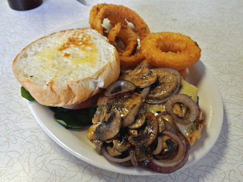
Badland's Burgers
"Route 66 Mushroom Swiss Burger".
Photo By Gil Garduno - October 26, 2013
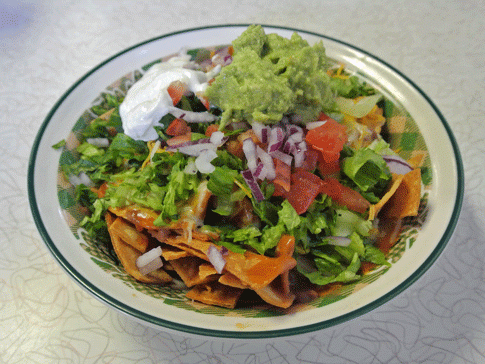
Badland's Burgers
"Fito Pie Supreme".
Photo By Gil Garduno - October 26, 2013

Badland's Burgers
Business Card

Badland's Burgers Exterior.
Photo by, Phil W. November 11, 2013
Artifact: Photos of Badland's Burgers and Tortas 2013
Source 1: © Steve Lagreca | Dreamstime.com
Source 2: Gil Garduno | https://www.roadsideamerica.com/tip/910?
Source 3: Phil W | https://www.roadshttps://www.nmgastronome.com/?p=28701ideamerica.com/tip/910?
Caption: Out through the back door of Rosa’s I ran,
Out where the horses were tied.
I caught a good one. It looked like it could run.
Up on its back and away I did ride,
Just as fast as I could from the West Texas town of El Paso
Out to the badlands of New Mexico.
~El Paso by Marty Robbins
2014
Grants — Carrot Capital of the World
Grants Cut and Mt. Taylor
Locomotive 2926 heading west through
Grants Cut
Elevation: 6,460 ft | Population: 9,134
2012 - 2022
"URANIUM CAFE"
BADLAND'S BURGERS
"HOME OF THE MILLIE BURGER"
The Mother Road
Will Rogers Highway
Owner: Daniel Chavez
Partner: Alfredo Garza
Manager:
Phone: 505 - 287 - 5557
2012 — Badland's Burgers Moves Location to the Former Uranium Cafe
On July 4, 2012, Badland's opened its new location in the former Uranium Cafe. The restaurant will continue to serve its menu from its former location in the old Maverik Country Store building.
A 1927 directory entry highlights the Yucca Hotel’s early reputation for consistent service and traveler accommodations.
2014— Uranium Cafe
Artifacts and Visuals
Source: Photographs courtesy of the Kiva Cafe and Elkins Family

Photo by Vagabondsforamonth - May 17, 2014

Photo by Vagabondsforamonth - May 17, 2014

Photo by Vagabondsforamonth - May 17, 2014
Artifact: Photos of Badland's Burgers 2014
Source: Wm Breiland | http://vagabondsforamonth.blogspot.com/2014/05/route-66-and-detour-to-monument-valley.html?m=1
Caption:
2015
Grants — Carrot Capital of the World
Grants Cut and Mt. Taylor
Locomotive 2926 heading west through
Grants Cut
Elevation: 6,460 ft | Population: 9,134
2011 - 2012
"URANIUM CAFE"
BADLAND'S BURGERS
"HOME OF THE MILLIE BURGER"
The Mother Road
Will Rogers Highway
Owner: Daniel Chavez
Partner: Alfredo Garza
Manager:
Phone: 505 - 287 - 5557
2014 — Badland's Burgers Closes
The Grants landmark Uranium Cafe closes once again after 59 years of serving western Valencia County and its latter Cibola County.
Of its owners through the course of time no matter how many names changes, one thing has always remained is the respect of keeping the name on the Uranium Cafe sign blade as well as the Cafe letters and neon design.
The Uranium Cafe sign blade is one of the many neon signs along the Historic Route 66 in Grants, New Mexico that deserves preservation and restoration to honor our once booming industry of uranium.
2015— Uranium Cafe
Artifacts and Visuals
Source: Photographs courtesy of the Kiva Cafe and Elkins Family
Uranium Cafe Blade Sign - 08/01/2011.
Photo by Wm Breiland
Artifact: Photos of Five Brothers Uranium Cafe June 29, 2007
Source: Wm Breiland | https://www.roadsideamerica.com/tip/910?offset=5
Caption:
A 1927 directory entry highlights the Yucca Hotel’s early reputation for consistent service and traveler accommodations.
2024
Grants — Carrot Capital of the World
Grants Cut and Mt. Taylor
Locomotive 2926 heading west through
Grants Cut
Elevation: 6,460 ft | Population: 9,134

2011 - 2012
"URANIUM CAFE"
BADLAND'S BURGERS
"HOME OF THE MILLIE BURGER"
The Mother Road
Will Rogers Highway
Owner: Daniel Chavez
Partner: Alfredo Garza
Manager:
Phone: 505 - 287 - 5557
2014 — Badland's Burgers Closes
The Grants landmark Uranium Cafe closes once again after 59 years of serving western Valencia County and its latter Cibola County.
Of its owners through the course of time no matter how many names changes, one thing has always remained is the respect of keeping the name on the Uranium Cafe sign blade as well as the Cafe letters and neon design.
The Uranium Cafe sign blade is one of the many neon signs along the Historic Route 66 in Grants, New Mexico that deserves preservation and restoration to honor our once booming industry of uranium.
2024— Uranium Cafe
Artifacts and Visuals
Source: Photographs courtesy of the Kiva Cafe and Elkins Family

Uranium Cafe
July 8, 2024.
Artifact: Photo of the former Historic Uranium Cafe. July 8, 2024
Source: LaJean Greeson | https://www.facebook.com/share/p/1D7zZ5u6nf/
Caption:
A 1927 directory entry highlights the Yucca Hotel’s early reputation for consistent service and traveler accommodations.
Downtown Grants
520 W. Santa Fe Avenue
at Iron Avenue (Grants Br.)
1912-1926
1912-1926
1926-1948
1948-1961
1961-1971
1971-1985
1912-1927
1927-Present
1972-Present
1985-Present
1951-Present
1985-Present
1985-Present
1985-Present
1991-Present
1998-Present
1998-Present
2010-Present
Route Shields of Grants-Milan and
surrounding areas on or connecting to
Historic US Route 66
Save Way Grocery & Market Parcel
The building at 110 W. Santa Fe Avenue was constructed in the late 1960s on the west end of the former Tropical Lounge/California Bar parcel. This subdivision occurred before the bar was demolished, and the new structure appears in late‑1960s photographs of the California Bar.
The first documented tenant was Pacific Finance, which relocated here by 1973 after previously operating at 807 W. Santa Fe Avenue in 1966, 1967, and 1968. Over the next five decades, the building housed a sequence of small professional, retail, and service businesses that reflect the changing needs of Grants residents as Santa Fe Avenue transitioned from a Route 66 travel corridor into a locally focused business district.
The development of 110 W. Santa Fe reflects the final wave of mid‑century infill along the 100 block, providing new commercial space as Grants expanded and diversified.
1950
Grants — Carrot Capital of the World
Grants Cut and Mt. Taylor
Locomotive 2926 heading west through
Grants Cut
Elevation: 6,460 ft | Population: 7,500
SAVE WAY GROCERY & MARKET
1950 - 197x
Owner: Wiley and Nell Holman
Manager:
Phone: 43
1927 — Yucca Hotel Expands Services
By 1927, the Yucca Hotel had become one of Grants’ most reliable lodging houses, offering meals, rooms, and traveler accommodations during the early years of Route 66. Local directory listings from this period show the hotel advertising steady service and dependable management, reflecting its growing role as a community anchor before the major highway boom of the 1930s.
1950— Save Way Grocery & Market
Artifacts and Visuals
Source: Photographs courtesy of the Kiva Cafe and Elkins Family
Grants High School "Pirates Ahoy"
1969 sponsor ad section for the
Lux Theatre
Artifact: 1954 Grants High School "Pirates Ahoy" Sponsor Ad for Save Way Grocery & Market
Source: https://www.facebook.com/share/p/1Brk8cLhgJ/
Image Courtesy: David Chapman
Caption:
A 1927 directory entry highlights the Yucca Hotel’s early reputation for consistent service and traveler accommodations.
1954
Grants — Carrot Capital of the World
Grants Cut and Mt. Taylor
Locomotive 2926 heading west through
Grants Cut
Elevation: 6,460 ft | Population: 7,500
2011 - 2012
SAVE WAY GROCERY & MARKET
The Mother Road
Will Rogers Highway
Owner: Wiley and Nell Holman & Sons
Manager:
Phone: 106 - W
1927 — Yucca Hotel Expands Services
By 1927, the Yucca Hotel had become one of Grants’ most reliable lodging houses, offering meals, rooms, and traveler accommodations during the early years of Route 66. Local directory listings from this period show the hotel advertising steady service and dependable management, reflecting its growing role as a community anchor before the major highway boom of the 1930s.
1954— Save Way Grocery & Market
Artifacts and Visuals
Source: Photographs courtesy of the Kiva Cafe and Elkins Family

Grants High School "Pirates Ahoy"
1969 sponsor ad section for the
Lux Theatre
Artifact: 1954 Grants High School "Pirates Ahoy" Sponsor Ad for Save Way Grocery & Market
Source: https://www.facebook.com/share/p/1Brk8cLhgJ/
Image Courtesy: David Chapman
Caption:
A 1927 directory entry highlights the Yucca Hotel’s early reputation for consistent service and traveler accommodations.
1956
Grants — Carrot Capital of the World
Grants Cut and Mt. Taylor
Locomotive 2926 heading west through
Grants Cut
Elevation: 6,460 ft | Population: 7,500
2011 - 2012
SAVE WAY GROCERY & MARKET
The Mother Road
Will Rogers Highway
Owner: Wiley and Nell Holman & Sons
Manager:
Phone: AT 7 - 4683
1927 — Yucca Hotel Expands Services
By 1927, the Yucca Hotel had become one of Grants’ most reliable lodging houses, offering meals, rooms, and traveler accommodations during the early years of Route 66. Local directory listings from this period show the hotel advertising steady service and dependable management, reflecting its growing role as a community anchor before the major highway boom of the 1930s.
A 1927 directory entry highlights the Yucca Hotel’s early reputation for consistent service and traveler accommodations.
Artifact: 1954 Grants High School "Pirates Ahoy" Sponsor Ad for Save Way Grocery & Market
Source: https://www.facebook.com/share/p/1Brk8cLhgJ/
Image Courtesy: David Chapman, Original Post by: LaJean Greeson
Caption:
1956— Save Way Grocery & Market
Artifacts and Visuals
Source: Photographs courtesy of the Kiva Cafe and Elkins Family

Grants High School "Pirates Ahoy"
1956 sponsor ad section for the
Save Way Grocery & Market


Grants High School "Pirates Ahoy"
1969 sponsor ad section for the
Lux Theatre
1964
Grants — Carrot Capital of the World
Grants Cut and Mt. Taylor
Locomotive 2926 heading west through
Grants Cut
Elevation: 6,460 ft | Population: 9,110
2011 - 2012
SAVE WAY GROCERY & MARKET
The Mother Road
Will Rogers Highway
Owner: Wiley and Nell Holman & Sons
Manager:
Phone: AT 7 - 4683
1927 — Yucca Hotel Expands Services
By 1927, the Yucca Hotel had become one of Grants’ most reliable lodging houses, offering meals, rooms, and traveler accommodations during the early years of Route 66. Local directory listings from this period show the hotel advertising steady service and dependable management, reflecting its growing role as a community anchor before the major highway boom of the 1930s.
A 1927 directory entry highlights the Yucca Hotel’s early reputation for consistent service and traveler accommodations.
1956— Save Way Grocery & Market
Artifacts and Visuals
Source: Photographs courtesy of the Kiva Cafe and Elkins Family
Grants High School "Pirates Ahoy"
1956 sponsor ad section for the
Save Way Grocery & Market
Grants High School "Pirates Ahoy"
1969 sponsor ad section for the
Lux Theatre
Artifact: 1954 Grants High School "Pirates Ahoy" Sponsor Ad for Save Way Grocery & Market
Source: https://www.facebook.com/share/p/1Brk8cLhgJ/
Image Courtesy: David Chapman, Original Post by: LaJean Greeson
Caption:
2011 - 2012
SAVE WAY GROCERY & MARKET
The Mother Road
Will Rogers Highway
Owner: Wiley and Nell Holman & Sons
Manager:
Phone: AT 7 - 4683
1927 — Yucca Hotel Expands Services
By 1927, the Yucca Hotel had become one of Grants’ most reliable lodging houses, offering meals, rooms, and traveler accommodations during the early years of Route 66. Local directory listings from this period show the hotel advertising steady service and dependable management, reflecting its growing role as a community anchor before the major highway boom of the 1930s.
A 1927 directory entry highlights the Yucca Hotel’s early reputation for consistent service and traveler accommodations.
1963— Save Way Grocery & Market
Artifacts and Visuals
Source: Photographs courtesy of the Kiva Cafe and Elkins Family

Grants High School "Pirates Ahoy"
1969 sponsor ad section for the
Lux Theatre
Grants High School "Pirates Ahoy"
1969 sponsor ad section for the
Lux Theatre
Artifact: 1954 Grants High School "Pirates Ahoy" Sponsor Ad for Save Way Grocery & Market
Source: https://www.facebook.com/share/p/1Brk8cLhgJ/
Image Courtesy: David Chapman, Original Post by: LaJean Greeson
Caption:
Downtown Grants
523 W. Santa Fe Avenue
at Iron Avenue (Grants Br.)
1912-1926
1912-1926
1926-1948
1948-1961
1961-1971
1971-1985
1912-1927
1927-Present
1972-Present
1985-Present
1951-Present
1985-Present
1985-Present
1985-Present
1991-Present
1998-Present
1998-Present
2010-Present
Route Shields of Grants-Milan and
surrounding areas on or connecting to
Historic US Route 66
United States Postal Service Parcel
The building at 110 W. Santa Fe Avenue was constructed in the late 1960s on the west end of the former Tropical Lounge/California Bar parcel. This subdivision occurred before the bar was demolished, and the new structure appears in late‑1960s photographs of the California Bar.
The first documented tenant was Pacific Finance, which relocated here by 1973 after previously operating at 807 W. Santa Fe Avenue in 1966, 1967, and 1968. Over the next five decades, the building housed a sequence of small professional, retail, and service businesses that reflect the changing needs of Grants residents as Santa Fe Avenue transitioned from a Route 66 travel corridor into a locally focused business district.
The development of 110 W. Santa Fe reflects the final wave of mid‑century infill along the 100 block, providing new commercial space as Grants expanded and diversified.
United States Postal Service (2)
1936 - 1950
Owner: United States Postal Service
Postmaster:
Phone:
The Yucca Hotel was developed beginning in 1909 through the partnership of George A. Ades and stonemason Joseph “Joe” Capelli, marking a major step in the transformation of the 1100 block of West Santa Fe Avenue into a structured commercial district. The project required the demolition of Latham’s Stockman’s Store, the original Latham location established on this site in 1882, which remained in operation here until 1910. The business later relocated within Grants before eventually returning to this original location in 1968.
Positioned directly across from the S. Bibo Brothers Mercantile (1105–1115 W), and within close proximity to the Atlantic & Pacific Railroad depot located behind the mercantile, the Yucca was strategically placed at the center of Grants’ early economic activity. This location allowed the hotel to serve railroad workers, traveling salesmen, and early automobile traffic moving through the corridor.
Working together, Ades and Capelli combined development and construction expertise to create a building that functioned as both a lodging establishment and a commercial hub. Their work reflects the shift from early settlement structures to more permanent business buildings, signaling the continued growth of Grants from its Los Alamitos origins into a functioning regional service center.
United States Postal Service (Before and After)
COMING SOON
(No surviving pre‑Yucca block photo)


Earliest 1928–1929 horizontal sign photo
-
Same‑day bus photo
-
Horizontal sign installed
-
Pole removed
-
Lamp posts visible
-
Scaffold mount visible
YUCCA
1910–1927 Yucca Hotel Rooftop Sign (Recreation)
Artifact: Recreation of the 1910–1927 Yucca Hotel rooftop sign based on later photographic evidence
Source: Cibola County Historical Museum — earliest 1928–1929 Yucca Hotel horizontal sign photograph (lamp posts visible, pole removed, scaffold mount)
Retrieved from: Cibola County Historical Museum photo archives; 1928–1929 streetscape reference materials
Caption: Rooftop sign recreation informed by the 1928–1929 horizontal sign photo showing lamp posts, scaffold mount, and the earliest surviving evidence of the hotel’s signage evolution
Building Spec List for the LUX Theater
● Designed by: ○ George Ades (owner/developer) ○ Joseph “Joe” Capelli (stonemason / craftsman / installer)
● Built by: ○ George Ades (owner/builder) ○ Joseph “Joe” Capelli (stonemason / construction and fabrication)
● Building / Sign Style: ○ Two‑story Spanish‑style exterior ○ Frame and stucco construction
● Built: ○ Construction began 1909 ○ Building completed 1910
● Opened: ○ 1910 (hotel begins operation) ○ 1911 — Charles Katzung becomes first confirmed manager
○ Earlier employment possible but undocumented
● Units / Rooms / Dimensions:
○ 13 upstairs guest rooms
○ 7 downstairs business rooms ○ 20 rooms total
● Amenities: ○ Pool: ○ None ○ Playground: ○ None
● Materials: ○ Wood framing ○ Stucco exterior ○ Early storefront façade elements
● Colors: ○ Period‑appropriate neutral stucco tones ○ Dark trim (per early photos)
● Mounting / Construction: ○ Traditional early‑20th‑century frame‑and‑stucco build
○ Street‑facing façade with early signage mount
Era Covered: ○ 1909–1912 (construction through early operation)
Operational Notes: ○ Lodging and dining operation ○ Served railroad workers, early auto travelers, and locals ○ Stable early operation under Katzung (from 1911)
● Identification Method: ○ Painted horizontal sign mounted at roof edge
● Period Context: ○ Territorial‑to‑statehood transition (NM statehood 1912) ○ Early automobile travel era
● Regional / Community Role: ○ Early anchor business in the Grants commercial core ○ Provided meals and lodging for local workforce
● Years in Service: ○ 56 years (1910–1966)
● Demolished / Fate:
○ Demolished 1966
Sign Spec List for the Yucca Hotel
● Designed by: ○ George Ades (owner/developer) ○ Joseph “Joe” Capelli (stonemason / craftsman / installer)
● Built by: ○ George Ades (owner/builder) ○ Joseph “Joe” Capelli (stonemason / construction and fabrication)
● Built: ○ Construction began 1909 ○ Installed by 1910 at hotel opening
● Installation: ○ In use by 1910
○ Still in use under Katzung by 1911
○ Earlier employment possible but undocumented
● Dimensions / Physical Characteristics:
○ Exact panel dimensions undocumented
○ Mounted above the roofline for visibility
○ Supported by metal frame and guy wires
○ Slightly offset from center
● Materials: ○ Painted wood sign face
○ Metal rear bracing
○ Metal support frame
○ Brackets, bolts, fasteners
○ Raw metal components
● Colors:
○ Case Color:
○ Forest Green
○ Lettering:
○ Cream White
○ Border:
○ Black
○ Metal components:
○ Raw/unpainted
Era Covered:
○ 1909–1912 (construction through early operation)
Mounting / Construction:
○ Lodging and dining operation ○ Served railroad workers, early auto travelers, and locals ○ Stable early operation under Katzung (from 1911)
● Identification Method: ○ Painted horizontal sign mounted at roof edge
● Period Context: ○ Territorial‑to‑statehood transition (NM statehood 1912) ○ Early automobile travel era
● Regional / Community Role: ○ Early anchor business in the Grants commercial core ○ Provided meals and lodging for local workforce
● Years in Service: ○ 56 years (1910–1966)
● Demolished / Fate:
○ Removed and lost during demolition 1966
The 100 block of West Santa Fe Avenue represents the earliest phase of commercial development in Grants, established following the 1912 relocation of the Atchison, Topeka & Santa Fe Railway depot to 101 W. Santa Fe Avenue. Early businesses, including the Woodard Hotel, Grants Drug, and the Whiteside Hotel & Café at 114 W., served railroad workers, travelers, and the growing local population from wood-frame structures typical of the period. Construction within this block was part of the early development activity involving George A. Ades and stonemason Joseph “Joe” Capelli, whose work contributed to the formation of the town’s initial commercial core. This early district was largely destroyed in the Great Fire of 1936, marking a turning point in the corridor’s development. In the years surrounding this transition, infrastructure improvements played a critical role, as Carroll Gunderson established electrical service while George A. Ades controlled the water system, together enabling the expansion of more permanent, masonry-built commercial structures westward along Santa Fe Avenue.
Ades & Capelli Development Network
Santa Fe Avenue Commercial Corridor
🔷 1100 BLOCK
📍 1100 W. Santa Fe Ave
Yucca Hotel (1909–1911 | Rebuild 1916)
-
Dev: George A. Ades
-
Build: Joseph Capelli
-
Lot: Block 11, Lot 1
-
Prev: Latham’s Store (1882–1910)
-
Features: 2-story, stucco, basalt foundation
-
Systems: well, water tower, steam boiler
Interior / Ground Floor:
-
Yucca Café (Ades)
-
Cocktail Lounge
-
Western Union
-
Blue Bell Telephone
-
Grants Barber Shop (Art Baca)
-
Western Auto
-
City Bakery (Masons)
-
Graham’s Jewelers
-
Grants Review (J.M. Chapman)
-
Brown’s Shoes & Repair
-
Grants State Bank (temporary office)
-
Ticket Stand / Depot Counter
Second Floor — Professional Offices
Occupants:
-
Physician (Doctor’s Office)
-
Dentist Office
📍 1112 W
Grants Theater (1910 | c.1915–1920 structure phase)
-
Dev: Ades
📍 1114 W
White Arrow Garage (1913)
-
Dev: Ades
-
Masonry: Capelli
📍 1116 W
Ades Commercial Building (c.1920)
-
Tenants: Laundromat (Garcias), Radio Repair
📍 1120 W
Ades Liquor Store (1940s)
📍 1100 Block (Rear)
Service / Utility Structures (c.1912–1915)
-
Dev: Ades
-
Build: Capelli
🔷 1000 BLOCK
📍 1000 W. Santa Fe Avenue
Abe’s Liquor Store
-
Build: Joesph "Joe" Capelli
-
Dev: George A. Ades
📍 1001 W. Santa Fe Avenue (Rt 66)
Huxford's Dry Goods (19xx-19xx)
-
Dev: Ades
📍 1012 W. Santa Fe Avenue (Rt 66)
Huxford's Dry Goods (19xx-19xx)
-
Dev: Ades
📍 1013 W. Santa Fe Avenue (Rt 66)
The Mint Cafe & Bar (1936-19xx)
-
Dev: Bibo
-
Build: Joesph "Joe" Capelli
📍 1014 W. Santa Fe Avenue
Violetta's Beauty Shop
-
Dev: Ades
-
Build: Capelli
📍 1016 W. Santa Fe Avenue
Ades Building (The Commerce Building)
-
Dev: Ades
-
Build: Capelli
📍 1018 W
Lux Theatre (1937)
-
Dev: George A. Ades
-
Owner: George A. Ades and Cyrus Souris
-
Build: Joseph "Joe" Capelli
-
Partner: Cyrus Souris
📍 1020 W
Grants State Bank (1947)
-
Dev: Ades
📍 1022 W
Carridine’s Drug Store (1944)
-
Dev: Ades
-
Owner: W.E. Carridine
-
Build: Capelli
-
Structure: masonry + frame
-
Facade: stucco + brick
🔷 900 BLOCK
📍 915 W
Ades Professional Building (c.1930s)
🔷 800 BLOCK
📍 800–810 W
Utility Annex / Rental Units (c.1930s)
🔷 700 BLOCK
📍 712 W
Variety Store Building (c.1928–1932)
🔷 600 BLOCK
📍 600–610 W. Santa Fe Ave
Structure: Commercial Building
Built: c.1925–1930
Developed By:
-
George A. Ades
Constructed By:
-
Joseph Capelli
Use:
-
Retail / commercial storefronts
🔷 500 BLOCK
📍 500 W. Santa Fe Ave
Structure: Chamber of Commerce Building
Built: 1940s
Developed By:
-
George A. Ades
📍 501 W. Santa Fe Ave
Structure: Modern Cleaners
Built: c.1935
Developed By:
-
George A. Ades
📍 508 W. Santa Fe Ave
Structure: Grants Hardware
Developed By:
-
George A. Ades
Constructed By:
-
Joseph Capelli
Operated By:
-
Walker Family
📍 512 W. Santa Fe Ave
Structure: Westerner Shop
Built: 1940s
Developed By:
-
George A. Ades
📍 515 W. Santa Fe Ave
Structure: Multi-Unit Retail Building
Built: 1940s
Developed By:
-
George A. Ades
🔷 400 BLOCK
📍 400 W. Santa Fe Ave
Structure: Grants Lumber & Sun Valley
Developed By:
-
George A. Ades
📍 408 W. Santa Fe Ave
Structure: Trade Shop Building
Built: 1940s
Developed By:
-
George A. Ades
Use:
-
Shoe repair
-
trade services
📍 421 W. Santa Fe Ave
Structure: Utility Warehouse
Built: 1940s
Developed By:
-
George A. Ades
🔷 300 BLOCK
📍 300–310 W. Santa Fe Ave
Structure: City Hall / Jail / Fire Department
Associated With:
-
George A. Ades
📍 312 W. Santa Fe Ave
Structure: Retail Units
Developed By:
-
George A. Ades
Use:
-
Tailor
-
Cobbler
📍 320 W. Santa Fe Ave
Structure: Post Office Lot
🔷 200 BLOCK
📍 200 W. Santa Fe Ave
Structure: Grants Garage / Chevrolet Garage
Built: c.1910 | Expanded 1918
Developed By:
-
George A. Ades
📍 204 W. Santa Fe Ave
Structure: Grants Mercantile
Built: c.1910
Developed By:
-
George A. Ades
📍 210 W. Santa Fe Ave
Structure: Orange Front Soda Shop
Built: c.1920
Developed By:
-
George A. Ades
Manager:
-
Claude Bowlin
📍 212–214 W. Santa Fe Ave
Structure: Grants Hall (formerly Valencia Hall)
Built: 1929
Developed By:
-
George A. Ades
Constructed By:
-
Joseph Capelli
📍 218 W. Santa Fe Ave
Structure: Red Ball Garage
Built: c.1930
Developed By:
-
George A. Ades
🔷 100 BLOCK
📍 100 Block W. Santa Fe Ave
Context:
-
Earliest commercial core of Grants
-
Developed following 1912 depot relocation to 101 W
-
Comprised of wood-frame structures prior to later masonry development
📍 c.1916 — Hotel Woodard
-
Wood-frame hotel
-
Railroad-era lodging
📍 c.1917 — Grants Drug
-
Pharmacy / retail
-
Served hotel corridor
📍 114 W. Santa Fe Ave — Whiteside Hotel & Café
Built: 1918
Owner / Operator:
-
Whiteside
Structure:
-
Wood-frame
Function:
-
Hotel + café
Construction Context:
-
Part of early builder/trade network preceding Ades–Capelli system
🔥 📍 1936 — THE GREAT FIRE OF 1936
Destroyed:
-
Woodard Hotel
-
Whiteside Hotel & Café
-
Grants Drug
-
Surrounding early commercial structures
🔍 IMPACT
-
Removed original downtown core
-
Transition to masonry + planned development
⚡💧 INFRASTRUCTURE (PLACE AT BOTTOM OR FULL WIDTH)
📍 1928 — POWER & WATER SYSTEMS
Power Provided By:
-
Carroll Gunderson
Water System Developed By:
-
George A. Ades
🔧 FUNCTION
-
Enabled modern commercial expansion
-
Supported theaters, hotels, utilities, and retail
🧠 SIGNIFICANCE
-
Marks transition to modern Grants infrastructure
-
Foundation for full corridor development
🪨 MALPAIS BASALT QUARRY
Owned By:
-
George A. Ades
-
Joseph Capelli
Purpose:
-
Structural material for corridor buildings
1936
Grants — Carrot Capital of the World
Grants Cut and Mt. Taylor
Locomotive 2926 heading west through
Grants Cut
Elevation: 6,460 ft | Population: 2,010
1927 — Yucca Hotel Expands Services
By 1927, the Yucca Hotel had become one of Grants’ most reliable lodging houses, offering meals, rooms, and traveler accommodations during the early years of Route 66. Local directory listings from this period show the hotel advertising steady service and dependable management, reflecting its growing role as a community anchor before the major highway boom of the 1930s.
1966 - 2012
COOK'S PAINT & HARDWARE
PAINTING CONTRACTORS
The Mother Road
Will Rogers Highway
Owner: Al Cook
Manager:
Phone: 287 - 3829 \ 287 - 4222
A 1927 directory entry highlights the Yucca Hotel’s early reputation for consistent service and traveler accommodations.
1966 — Cook's Paint & Hardware
Artifacts and Visuals
Source: Photographs courtesy of the Kiva Cafe and Elkins Family

Grants High School "Pirates Ahoy"
1969 sponsor ad section for the
Lux Theatre

Grants High School "Pirates Ahoy"
1969 sponsor ad section for the
Lux Theatre

Grants High School "Pirates Ahoy"
1969 sponsor ad section for the
Lux Theatre
Artifact 1: 1955 Grants High School "Pirates Ahoy" Sponsor Ad for the LUX Theatre
Artifact 2:
Artifact 3:
Source: Shawn Barringer | https://www.facebook.com/share/p/1BESHbmqfu/
Caption:
1968
Grants — Carrot Capital of the World
Grants Cut and Mt. Taylor
Locomotive 2926 heading west through
Grants Cut
Elevation: 6,460 ft | Population: 9,110
1927 — Yucca Hotel Expands Services
By 1927, the Yucca Hotel had become one of Grants’ most reliable lodging houses, offering meals, rooms, and traveler accommodations during the early years of Route 66. Local directory listings from this period show the hotel advertising steady service and dependable management, reflecting its growing role as a community anchor before the major highway boom of the 1930s.
1966 - 2012
COOK'S PAINT & HARDWARE
PAINTING CONTRACTORS
The Mother Road
Will Rogers Highway
Owner: Al Cook
Manager:
Phone: 287 - 3829 \ 287 - 4222
A 1927 directory entry highlights the Yucca Hotel’s early reputation for consistent service and traveler accommodations.
1968 — Cook's Paint & Hardware
Artifacts and Visuals
Source: Photographs courtesy of the Kiva Cafe and Elkins Family
Grants High School "Pirates Ahoy"
1969 sponsor ad section for the
Lux Theatre
Artifact: 1955 Grants High School "Pirates Ahoy" Sponsor Ad for the LUX Theatre
Source: Shawn Barringer | https://www.facebook.com/share/p/1BESHbmqfu/
Caption:
Grants High School "Pirates Ahoy"
1969 sponsor ad section for the
Lux Theatre
1969
Grants — Carrot Capital of the World
Grants Cut and Mt. Taylor
Locomotive 2926 heading west through
Grants Cut
Elevation: 6,460 ft | Population: 9,110
L & G HOME FURNISHINGS
1969 - 1980
Owner:
Manager:
Phone: 287 - 4618
1927 — Yucca Hotel Expands Services
By 1927, the Yucca Hotel had become one of Grants’ most reliable lodging houses, offering meals, rooms, and traveler accommodations during the early years of Route 66. Local directory listings from this period show the hotel advertising steady service and dependable management, reflecting its growing role as a community anchor before the major highway boom of the 1930s.
1969 — L & G Home Furnishings
Artifacts and Visuals
Source: Photographs courtesy of the Kiva Cafe and Elkins Family

Grants High School "Pirates Ahoy"
1969 sponsor ad section for the
Lux Theatre
Artifact: 1955 Grants High School "Pirates Ahoy" Sponsor Ad for the LUX Theatre
Source: Shawn Barringer | https://www.facebook.com/share/p/1BESHbmqfu/
Caption:
1966 - 2012
L & G HOME FURNISHINGS
PAINTING CONTRACTORS
The Mother Road
Will Rogers Highway
Owner: Al Cook
Manager:
Phone: 287 - 3829 \ 287 - 4222
A 1927 directory entry highlights the Yucca Hotel’s early reputation for consistent service and traveler accommodations.
1972
Grants — Carrot Capital of the World
Grants Cut and Mt. Taylor
Locomotive 2926 heading west through
Grants Cut
Elevation: 6,460 ft | Population: 9,350
L & G HOME FURNISHINGS
1969 - 1980
Owner:
Manager:
Phone: 287 - 4618
1927 — Yucca Hotel Expands Services
By 1927, the Yucca Hotel had become one of Grants’ most reliable lodging houses, offering meals, rooms, and traveler accommodations during the early years of Route 66. Local directory listings from this period show the hotel advertising steady service and dependable management, reflecting its growing role as a community anchor before the major highway boom of the 1930s.
1972 — L & G Home Furnishings
Artifacts and Visuals
Source: Photographs courtesy of the Kiva Cafe and Elkins Family

Grants High School "Pirates Ahoy"
1969 sponsor ad section for the
Lux Theatre
Artifact: 1955 Grants High School "Pirates Ahoy" Sponsor Ad for the LUX Theatre
Source: Shawn Barringer | https://www.facebook.com/share/p/1BESHbmqfu/
Caption:
A 1927 directory entry highlights the Yucca Hotel’s early reputation for consistent service and traveler accommodations.
2007
Grants — Carrot Capital of the World
Grants Cut and Mt. Taylor
Locomotive 2926 heading west through
Grants Cut
Elevation: 6,460 ft | Population: 9,134

2007 - 2012
GRANTS MAINSTREET PROJECT INC. Suite A
Grants MainStreet Project - Festivals, Economic Development
The Mother Road
Will Rogers Highway
Owner: Grants Mainstreet Project Inc.
Partner: City of Grants
Manager:
Phone: 505 - 287 -
2007 - 2012
CIBOLA BEACON
Suite B

The Mother Road
Will Rogers Highway
Owner:
Manager:
Phone: 505 - 287 -
Grants High School "Pirates Ahoy"
1969 sponsor ad section for the
Lux Theatre
Artifact: 1955 Grants High School "Pirates Ahoy" Sponsor Ad for the LUX Theatre
Source: Shawn Barringer | https://www.facebook.com/share/p/1BESHbmqfu/
Caption:
2007 — Artifacts and Visuals
1927 — Yucca Hotel Expands Services
By 1927, the Yucca Hotel had become one of Grants’ most reliable lodging houses, offering meals, rooms, and traveler accommodations during the early years of Route 66. Local directory listings from this period show the hotel advertising steady service and dependable management, reflecting its growing role as a community anchor before the major highway boom of the 1930s.
A 1927 directory entry highlights the Yucca Hotel’s early reputation for consistent service and traveler accommodations.
2009
Grants — Carrot Capital of the World
Grants Cut and Mt. Taylor
Locomotive 2926 heading west through
Grants Cut
Elevation: 6,460 ft | Population: 9,134
2007 - 2012
GRANTS MAINSTREET PROJECT INC. Suite A
Grants MainStreet Project - Festivals, Economic Development
The Mother Road
Will Rogers Highway
Owner: Grants Mainstreet Project Inc.
Partner: City of Grants
Manager:
Phone: 505 - 287 -
2007 - 2012
CIBOLA BEACON
Suite B
The Mother Road
Will Rogers Highway
Owner:
Manager:
Phone: 505 - 287 -

Grants High School "Pirates Ahoy"
1969 sponsor ad section for the
Lux Theatre
Artifact: 1955 Grants High School "Pirates Ahoy" Sponsor Ad for the LUX Theatre
Source: Shawn Barringer | https://www.facebook.com/share/p/1BESHbmqfu/
Caption:
2026 — Artifacts and Visuals
1927 — Yucca Hotel Expands Services
By 1927, the Yucca Hotel had become one of Grants’ most reliable lodging houses, offering meals, rooms, and traveler accommodations during the early years of Route 66. Local directory listings from this period show the hotel advertising steady service and dependable management, reflecting its growing role as a community anchor before the major highway boom of the 1930s.
A 1927 directory entry highlights the Yucca Hotel’s early reputation for consistent service and traveler accommodations.
CIBOLA BEACON
1936 - 1980
Owner: Bob & Elizabeth Huxford
Manager:
Phone: At 7- 4223
CIBOLABEACON.COM

1927 — Yucca Hotel Expands Services
By 1927, the Yucca Hotel had become one of Grants’ most reliable lodging houses, offering meals, rooms, and traveler accommodations during the early years of Route 66. Local directory listings from this period show the hotel advertising steady service and dependable management, reflecting its growing role as a community anchor before the major highway boom of the 1930s.
A 1927 directory entry highlights the Yucca Hotel’s early reputation for consistent service and traveler accommodations.
2009 — Cibola Beacon
Artifacts and Visuals
Source: Photographs courtesy of the Kiva Cafe and Elkins Family
Grants High School "Pirates Ahoy"
1969 sponsor ad section for the
Lux Theatre
Artifact: 1955 Grants High School "Pirates Ahoy" Sponsor Ad for the LUX Theatre
Source: Shawn Barringer | https://www.facebook.com/share/p/1BESHbmqfu/
Caption:
2009
Grants — Carrot Capital of the World
Grants Cut and Mt. Taylor
Locomotive 2926 heading west through
Grants Cut
Elevation: 6,460 ft | Population: 9,134